South Shore, Pittsburgh
Map
Facts and practical information
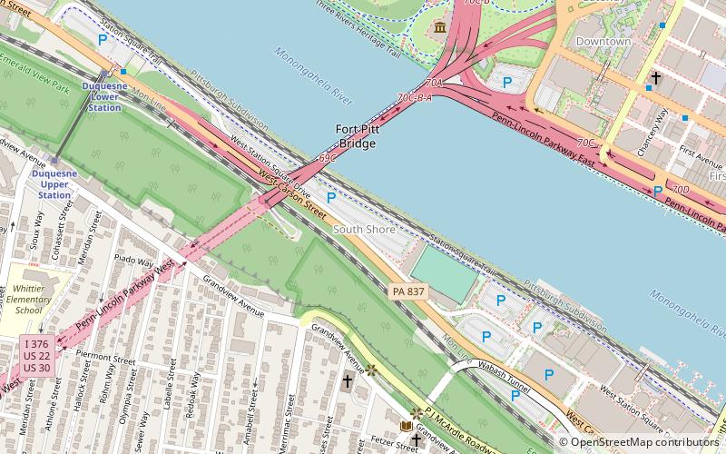
The South Shore is a neighborhood in Pittsburgh, Pennsylvania South Side. The South Shore consists of the area surrounding Carson Street, from the West End Bridge to the Liberty Bridge. ()
Area: 135.68 acres (0.212 mi²)Coordinates: 40°26'14"N, 80°0'41"W
Address
South Side (South Shore)Pittsburgh
ContactAdd
Social media
Add
Getting there by public transportation
Public transportation stops near this location
- Bus
- Light rail
- Train
 Bus
Bus
- Calculate routeBlvd of the Allies at Stanwix Street 11 min walk
- Calculate routeLiberty Ave at Wyndham Grand 11 min walk
- Calculate routeLiberty Ave at Stanwix St 12 min walk
- Calculate routeBoulevard of the Allies at Wood St 13 min walk
- Calculate routeStation Square 15 min walk
- Calculate routeWood Street 19 min walk
- Calculate routeNorth Side 19 min walk
- Calculate routeFirst Avenue 21 min walk
- Calculate routePittsburgh Union Station 30 min walk
Day trips


Frequently Asked Questions (FAQ)
Which popular attractions are close to South Shore?
Nearby attractions include Trib Total Media Amphitheatre, Pittsburgh (1 min walk), Fort Pitt Bridge, Pittsburgh (3 min walk), Highmark Stadium, Pittsburgh (3 min walk), Mount Washington Branch of the Carnegie Library of Pittsburgh, Pittsburgh (6 min walk).
How to get to South Shore by public transport?
The nearest stations to South Shore:
Bus
Light rail
Train
Bus
- Blvd of the Allies at Stanwix Street • Lines: 3 (11 min walk)
- Liberty Ave at Wyndham Grand • Lines: Metro Commuter, P10 (11 min walk)
Light rail
- Station Square • Lines: Blue, Red, Silver (15 min walk)
- Wood Street • Lines: Blue, Red, Silver (19 min walk)
Train
- Pittsburgh Union Station (30 min walk)