Jay's Longhorn Bar, Minneapolis
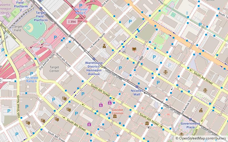
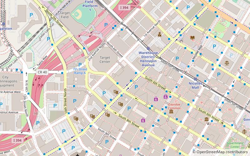
Map
Facts and practical information
Jay's Longhorn Bar was a nexus of the punk rock and New Wave scenes in Minneapolis, Minnesota, in the late 1970s and early 1980s. ()
Coordinates: 44°58'46"N, 93°16'18"W
Address
Central Minneapolis (Downtown West)Minneapolis
ContactAdd
Social media
Add
Getting there by public transportation
Public transportation stops near this location
- Bus
- Light rail
- Train
 Bus
Bus
- Calculate route5 St S 2 min walk
- Calculate route5 St / 6 St S 2 min walk
- Calculate routeHennepin Av 2 min walk
- Calculate route4th Street & Hennepin Avenue 2 min walk
- Calculate routeWarehouse District/Hennepin Avenue 3 min walk
- Calculate routeNicollet Mall 3 min walk
- Calculate routeGovernment Plaza 9 min walk
- Calculate routeTarget Field 11 min walk
- Calculate routeTarget Field 10 min walk
Day trips
Jay's Longhorn Bar – popular in the area (distance from the attraction)
Nearby attractions include: Nicollet Mall, First Avenue, Target Field, Target Center.


Frequently Asked Questions (FAQ)
Which popular attractions are close to Jay's Longhorn Bar?
Nearby attractions include 50 South Sixth, Minneapolis (2 min walk), Cowles Center for Dance and the Performing Arts, Minneapolis (2 min walk), Hennepin Center for the Arts, Minneapolis (3 min walk), 33 South Sixth, Minneapolis (3 min walk).
How to get to Jay's Longhorn Bar by public transport?
The nearest stations to Jay's Longhorn Bar:
Bus
Light rail
Train
Bus
- 5 St S • Lines: 4, 4B, 4G (2 min walk)
- 5 St / 6 St S • Lines: 4, 4A, 4L, 4P (2 min walk)
Light rail
- Warehouse District/Hennepin Avenue • Lines: 901, 902 (3 min walk)
- Nicollet Mall • Lines: 901, 902 (3 min walk)
Train
- Target Field (10 min walk)