Oakland, Chicago
Map
Facts and practical information
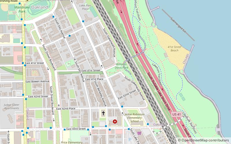
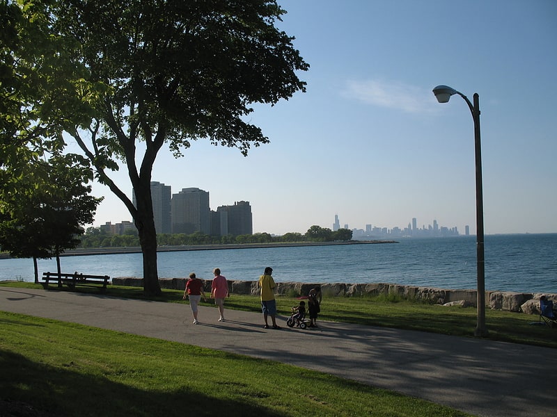
Oakland, located on the South Side of Chicago, Illinois, USA, is one of 77 officially designated Chicago community areas. Bordered by 35th and 43rd Streets, Cottage Grove Avenue and Lake Shore Drive, The Oakland area was constructed between 1872 and 1905. Some of Chicago's great old homes may be seen on Drexel Boulevard. The late 19th-century Monument Baptist Church on Oakwood Blvd. is modeled after Boston's Trinity Church. Oakwood /41st Street Beach in Burnham Park is at 4100 S. Lake Shore Drive. With an area of only 0.6 sq mi Oakland is the smallest community area by area in Chicago. ()
Area: 0.6 mi²Coordinates: 41°49'12"N, 87°35'60"W
Address
South Side (Oakland)Chicago
ContactAdd
Social media
Add
Getting there by public transportation
Public transportation stops near this location
- Metro
- Bus
- Train
 Metro
Metro
- Calculate route42nd Place & Lake Park 4 min walk
- Calculate routeBerkeley & 43rd Street 6 min walk
- Calculate route43rd Street & Lake Park 6 min walk
- Calculate route47th Street 22 min walk
- Calculate route43rd 26 min walk
- Calculate routeIndiana 29 min walk
- Calculate route47th 32 min walk
Maps Rail "L"
Rail "L"Day trips


Frequently Asked Questions (FAQ)
Which popular attractions are close to Oakland?
Nearby attractions include 4th Ward, Chicago (10 min walk), North Kenwood District, Chicago (12 min walk), Kenwood United Church of Christ, Chicago (16 min walk), Burnham Park, Chicago (21 min walk).
How to get to Oakland by public transport?
The nearest stations to Oakland:
Bus
Train
Metro
Bus
- 42nd Place & Lake Park • Lines: 43 (4 min walk)
- Berkeley & 43rd Street • Lines: 43 (6 min walk)
Train
- 47th Street (22 min walk)
Metro
- 43rd • Lines: Green (26 min walk)
- Indiana • Lines: Green (29 min walk)