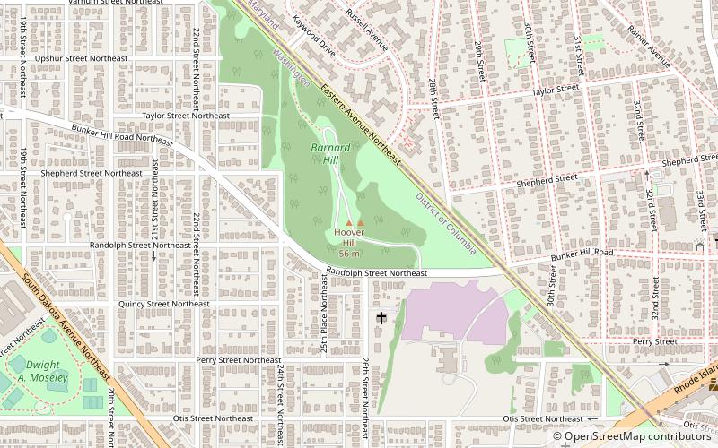
Barnard Hill Park, Washington D.C.
Map
Facts and practical information
Barnard Hill Park is an urban park located in the Washington, D.C. neighborhood of Woodridge; it also abuts the Maryland city of Mount Rainier. This 21.82 acre site is administered by the National Park Service as a part of Rock Creek Park, but is not contiguous with that park. Located on the border with Maryland, it is the eastern end of a corridor of contiguous greenspace from Fort Totten Park to Barnard Hill. ()
Elevation: 157 ft a.s.l.Coordinates: 38°56'19"N, 76°58'13"W
Getting there by public transportation
Public transportation stops near this location
- Metro
 Metro
Metro
- Calculate routeWest Hyattsville 30 min walk
Day trips


Frequently Asked Questions (FAQ)
Which popular attractions are close to Barnard Hill Park?
Nearby attractions include Franciscan Monastery, Washington D.C. (21 min walk), Brentwood, Mount Rainier (22 min walk), Woodridge Neighborhood Library, Washington D.C. (23 min walk), Brookland, Washington D.C. (24 min walk).
How to get to Barnard Hill Park by public transport?
The nearest stations to Barnard Hill Park:
Metro
Metro
- West Hyattsville • Lines: Gr, Yl (30 min walk)