West Huntington Bridge, Huntington
Map
Facts and practical information
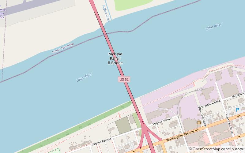
The West Huntington Bridge is a two-lane, 562-foot cantilever bridge on the west side of Huntington, West Virginia, United States. It crosses the Ohio River and carries U.S. Route 52 between Ohio State Route 7 and Interstate 64. ()
Coordinates: 38°24'57"N, 82°29'10"W
Getting there by public transportation
Public transportation stops near this location
- Bus
 Bus
Bus
- Calculate routeAdams Avenue & 18th Street West 10 min walk
- Calculate routeWashington Avenue & 11th Street West & Dutch Miller 15 min walk
Day trips


Frequently Asked Questions (FAQ)
How to get to West Huntington Bridge by public transport?
The nearest stations to West Huntington Bridge:
Bus
Bus
- Adams Avenue & 18th Street West • Lines: 1 (10 min walk)
- Washington Avenue & 11th Street West & Dutch Miller • Lines: 1 (15 min walk)