Bayside Expo Center, Boston
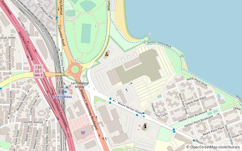
Map
Facts and practical information
Bayside Expo Center was a convention center located in Dorchester, Massachusetts. Originally opened as a shopping mall called Bayside Mall in the 1960s, the mall later failed and the convention center opened in its place. In 2010, it was purchased by the University of Massachusetts Boston after the building went into foreclosure. ()
Opened: 1960 (66 years ago)Coordinates: 42°19'17"N, 71°2'53"W
Address
200 Mount Vernon StDorchester (Columbia Point)Boston
ContactAdd
Social media
Add
Getting there by public transportation
Public transportation stops near this location
- Metro
- Bus
- Train
 Metro
Metro
- Calculate routeJFK/UMass 6 min walk
- Calculate routeNewmarket 26 min walk
- Calculate routeUphams Corner 28 min walk
- Calculate routeJFK/UMass 6 min walk
- Calculate routeAndrew 20 min walk
- Calculate routeDorchester Avenue @ Edison Green 13 min walk
- Calculate routeE Broadway @ G St 26 min walk
- Calculate route442 W Broadway 27 min walk
Maps MBTA Subway
MBTA SubwayDay trips
Bayside Expo Center – popular in the area (distance from the attraction)
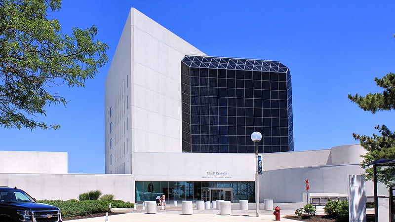
Nearby attractions include: Edward M. Kennedy Institute for the United States Senate, John F. Kennedy Presidential Library and Museum, Cathedral of St. George Historic District, South Bay Shopping Center.


Frequently Asked Questions (FAQ)
Which popular attractions are close to Bayside Expo Center?
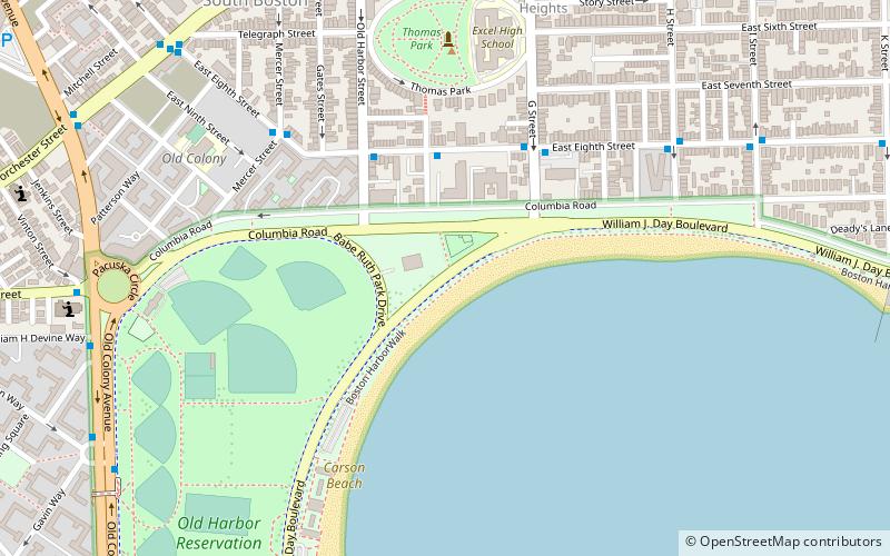
Nearby attractions include Carson Beach, Boston (7 min walk), Dorchester, Boston (9 min walk), Old Harbor Reservation Parkways, Boston (15 min walk), James Blake House, Boston (17 min walk).
How to get to Bayside Expo Center by public transport?
The nearest stations to Bayside Expo Center:
Train
Metro
Bus
Train
- JFK/UMass (6 min walk)
- Newmarket (26 min walk)
Metro
- JFK/UMass • Lines: Red (6 min walk)
- Andrew • Lines: Red (20 min walk)
Bus
- Dorchester Avenue @ Edison Green (13 min walk)
- E Broadway @ G St • Lines: 9 (26 min walk)