Glide Memorial Church, San Francisco

Gallery (1)
Map
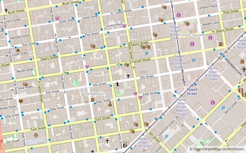
Map
Facts and practical information
Glide Memorial Church is a church in San Francisco, California, historically a United Methodist Church congregation, which opened in 1930. Although conservative until the 1960s, since then it has served as a counter-culture rallying point and has been one of the most prominently liberal churches in the United States. Glide is also famous for its Gospel Choir and numerous social service programs. The church building was listed on the National Register of Historic Places in 2022. ()
Completed: 1931 (95 years ago)Coordinates: 37°47'7"N, 122°24'43"W
Getting there by public transportation
Public transportation stops near this location
- Metro
- Bus
- Trolleybus
- Tram
- Light rail
- Train
- Ferry
 Metro
Metro
- Calculate routeO'Farrell Street & Taylor Street 2 min walk
- Calculate routeJones Street & Ellis Street 2 min walk
- Calculate routeGeary Street & Taylor Street 4 min walk
- Calculate routeMarket Street & Taylor Street 6 min walk
- Calculate routePowell Street & O'Farrell Street 6 min walk
- Calculate routePowell Street & Market Street 6 min walk
- Calculate routePowell Street 7 min walk
- Calculate routeCivic Center 11 min walk
- Calculate routeMontgomery Street 16 min walk
- Calculate routeVan Ness 21 min walk
- Calculate routePowell Street 7 min walk
- Calculate routeCivic Center 11 min walk
- Calculate routeMission Street & 5th Street 9 min walk
- Calculate routeStockton Street & Geary Street 9 min walk
- Calculate route4th Street & Market Street 10 min walk
- Calculate routeSan Francisco 4th & King Street 29 min walk
- Calculate routeFerry Building Gate B 34 min walk
Maps Muni Metro
Muni MetroDay trips
Glide Memorial Church – popular in the area (distance from the attraction)
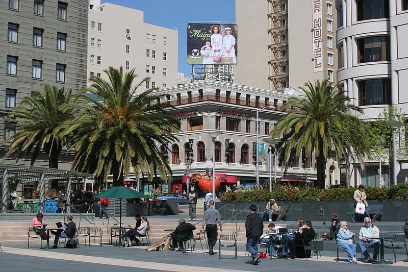
Nearby attractions include: Great American Music Hall, Westfield San Francisco Centre, Dewey Monument, Union Square.


Frequently Asked Questions (FAQ)
Which popular attractions are close to Glide Memorial Church?
Nearby attractions include Boeddeker Park, San Francisco (2 min walk), Curran Theatre, San Francisco (4 min walk), Tenderloin, San Francisco (4 min walk), Art Exchange, San Francisco (4 min walk).
How to get to Glide Memorial Church by public transport?
The nearest stations to Glide Memorial Church:
Bus
Tram
Light rail
Metro
Trolleybus
Train
Ferry
Bus
- O'Farrell Street & Taylor Street • Lines: 38, 38R (2 min walk)
- Jones Street & Ellis Street • Lines: 27 (2 min walk)
Tram
- Market Street & Taylor Street • Lines: F (6 min walk)
- Powell Street & O'Farrell Street (6 min walk)
Light rail
- Powell Street • Lines: K, N, S, T (7 min walk)
- Civic Center • Lines: K, N, S, T (11 min walk)
Metro
- Powell Street • Lines: Blue, Green, Red, Yellow (7 min walk)
- Civic Center • Lines: Blue, Green, Red, Yellow (11 min walk)
Trolleybus
- Mission Street & 5th Street • Lines: 14 (9 min walk)
- Stockton Street & Geary Street • Lines: 30, 45 (9 min walk)
Train
- San Francisco 4th & King Street (29 min walk)
Ferry
- Ferry Building Gate B • Lines: San Francisco Bay Ferry (34 min walk)