Great American Music Hall, San Francisco

Facts and practical information
Nestled in the heart of San Francisco, the Great American Music Hall carries a legacy as one of the city's most distinguished concert venues. With its ornate architecture and storied history, this hall has been a beacon for music lovers since its inception.
Constructed in 1907, the Great American Music Hall showcases a blend of extravagant decorations reminiscent of the city's Barbary Coast era. Its interiors are adorned with frescoes, chandeliers, and a grandiose marble staircase, making it a spectacle in its own right. The venue's capacity allows for an intimate yet vibrant atmosphere, with audiences reveling in the close proximity to world-class performers.
Throughout its existence, the Great American Music Hall has played host to a diverse array of musical acts, ranging from jazz and folk to rock and electronic. Its stage has been graced by legendary artists, cementing its reputation as a cornerstone of San Francisco's cultural landscape. The hall's acoustics are praised for their clarity and depth, offering an unparalleled auditory experience.
The venue is not only a concert hall but also a testament to San Francisco's resilience. It has survived the great earthquake of 1906, economic downturns, and the ever-changing tides of the music industry. Today, it continues to be a hub for both emerging talents and established musicians.
Accessible to locals and tourists alike, the Great American Music Hall operates year-round, providing a packed calendar of events to suit all tastes. Whether it's for a night of foot-tapping jazz or electrifying rock, the hall promises an unforgettable experience.
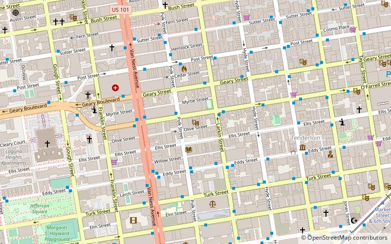
859 O'Farrell StNortheast San Francisco (Tenderloin)San Francisco
- Metro
- Bus
- Trolleybus
- Tram
- Light rail
 Metro
Metro
- Calculate routePolk Street & O'Farrell Street 2 min walk
- Calculate routeLarkin Street & O'Farrell Street 2 min walk
- Calculate routeO'Farrell Street & Larkin Street 2 min walk
- Calculate routeGeary Street & Larkin Street 3 min walk
- Calculate routeCalifornia Street & Polk Street 11 min walk
- Calculate routeCalifornia Street & Larkin Street 11 min walk
- Calculate routeCalifornia Street & Van Ness Avenue 11 min walk
- Calculate routeCalifornia Street & Hyde Street 12 min walk
- Calculate routeCivic Center 12 min walk
- Calculate routePowell Street 16 min walk
- Calculate routeVan Ness 17 min walk
- Calculate routeMontgomery Street 25 min walk
- Calculate routeCivic Center 12 min walk
- Calculate routePowell Street 17 min walk
- Calculate routeSacramento Street & Larkin Street 13 min walk
 Muni Metro
Great American Music Hall – popular in the area (distance from the attraction)
Nearby attractions include: The Regency Ballroom, San Francisco City Hall, Cathedral of Saint Mary of the Assumption, Asian Art Museum.


Frequently Asked Questions (FAQ)
Which popular attractions are close to Great American Music Hall?
How to get to Great American Music Hall by public transport?
Bus
- Polk Street & O'Farrell Street • Lines: 19 (2 min walk)
- Larkin Street & O'Farrell Street • Lines: 19 (2 min walk)
Tram
- California Street & Polk Street (11 min walk)
- California Street & Larkin Street (11 min walk)
Light rail
- Civic Center • Lines: K, N, S, T (12 min walk)
- Powell Street • Lines: K, N, S, T (16 min walk)
Metro
- Civic Center • Lines: Blue, Green, Red, Yellow (12 min walk)
- Powell Street • Lines: Blue, Green, Red, Yellow (17 min walk)
Trolleybus
- Sacramento Street & Larkin Street • Lines: 1 (13 min walk)