Sirrine Stadium, Greenville
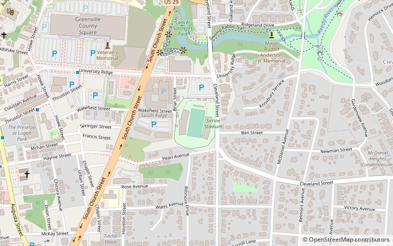
Map
Facts and practical information
Sirrine Stadium is a stadium in Greenville, South Carolina, United States. It was used by Furman University's American football team from 1936 to 1980. The stadium opened on October 31, 1936 with a Furman victory over Davidson. It has a seating capacity of 15,000. It is currently used by the Greenville High School Red Raiders and has hosted the HBCU Classic since 2005. It is the home of Greenville FC from the National Premier Soccer League. ()
Capacity: 15 thous.Coordinates: 34°50'18"N, 82°23'51"W
Getting there by public transportation
Public transportation stops near this location
- Bus
 Bus
Bus
- Calculate routeUniversity Ridge 9 min walk
- Calculate routeThruston @ Howe Street 11 min walk
- Calculate routeAugusta St @ Dunbar Street 13 min walk
- Calculate routeAugusta St @ Church Street 14 min walk
Day trips


Frequently Asked Questions (FAQ)
Which popular attractions are close to Sirrine Stadium?
Nearby attractions include Cancer Survivors Park, Greenville (6 min walk), McDaniel Park, Greenville (13 min walk), Liberty Bridge, Greenville (13 min walk), Falls Park on the Reedy, Greenville (13 min walk).
How to get to Sirrine Stadium by public transport?
The nearest stations to Sirrine Stadium:
Bus
Bus
- University Ridge • Lines: 4D (9 min walk)
- Thruston @ Howe Street • Lines: 4D (11 min walk)