Town & Country Club, Minneapolis
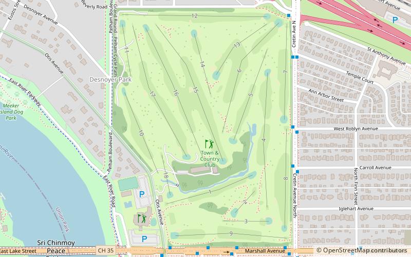
Map
Facts and practical information
Town & Country Club is a golf club located in St. Paul, Minnesota which was founded in 1888. Designed by George McCree and E. J. Frost, and later redesigned by Robert Foulis. Foulis, an early professional at Town & Country Club who was recommended to the membership by C.B. MacDonald. ()
Coordinates: 44°57'7"N, 93°11'46"W
Address
Merriam Park - Lexington - Hamline (Merriam Park West)Minneapolis
ContactAdd
Social media
Add
Getting there by public transportation
Public transportation stops near this location
- Bus
- Light rail
 Bus
Bus
- Calculate routeCleveland Av 18 min walk
- Calculate routeVandalia St 18 min walk
- Calculate routeTransfer Rd 19 min walk
- Calculate routeHampden Av 19 min walk
- Calculate routeRaymond Avenue 20 min walk
- Calculate routeFairview Avenue 24 min walk
- Calculate routeWestgate 31 min walk
Day trips


Frequently Asked Questions (FAQ)
Which popular attractions are close to Town & Country Club?
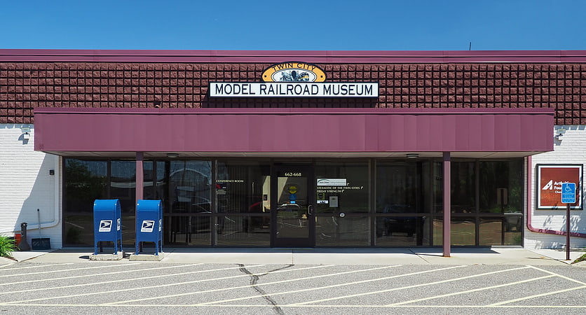
Nearby attractions include Lake Street-Marshall Bridge, Minneapolis (9 min walk), Merriam Park Recreation Center, Saint Paul (15 min walk), American Museum of Asmat Art, Saint Paul (19 min walk), Twin City Model Railroad Museum, Saint Paul (21 min walk).
How to get to Town & Country Club by public transport?
The nearest stations to Town & Country Club:
Bus
Light rail
Bus
- Cleveland Av • Lines: 67 (18 min walk)
- Vandalia St • Lines: 67, 67C (18 min walk)
Light rail
- Raymond Avenue • Lines: 902 (20 min walk)
- Fairview Avenue • Lines: 902 (24 min walk)