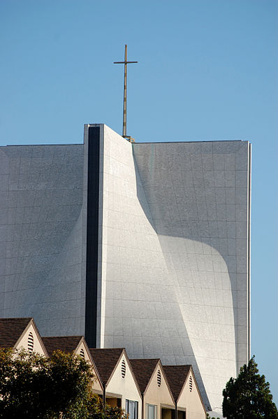
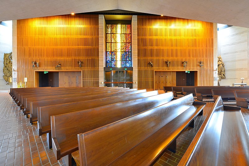
Cathedral of Saint Mary of the Assumption, San Francisco

Gallery (8)
Map

Map

Gallery
Facts and practical information
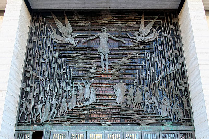
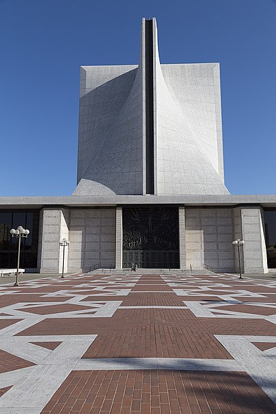
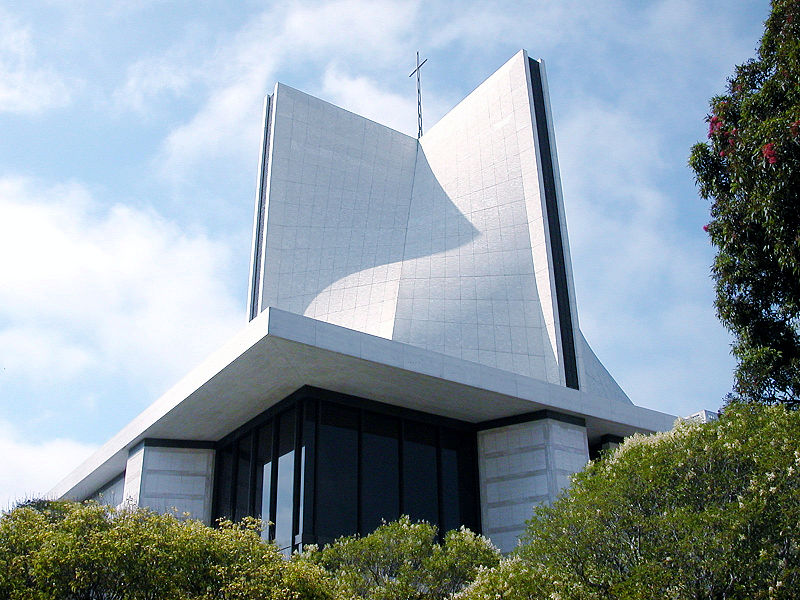
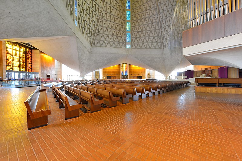
The Cathedral of Saint Mary of the Assumption, also known locally as Saint Mary's Cathedral, is the principal church of the Roman Catholic Archdiocese of San Francisco in San Francisco, California. It is the mother church of the Catholic faithful in the California counties of Marin, San Francisco and San Mateo and is the metropolitan cathedral for the Ecclesiastical province of San Francisco. ()
Getting there by public transportation
Public transportation stops near this location
- Metro
- Bus
- Trolleybus
- Tram
- Light rail
 Metro
Metro
- Calculate routeStarr King Way & Gough Street 3 min walk
- Calculate routeGeary Boulevard & Laguna Street 5 min walk
- Calculate routeO'Farrell Street & Van Ness Avenue 6 min walk
- Calculate routeFillmore Street & O'Farrell Street 11 min walk
- Calculate routeCalifornia Street & Van Ness Avenue 13 min walk
- Calculate routeCalifornia Street & Polk Street 14 min walk
- Calculate routeCalifornia Street & Larkin Street 15 min walk
- Calculate routeCalifornia Street & Hyde Street 17 min walk
- Calculate routeVan Ness 18 min walk
- Calculate routeCivic Center 18 min walk
- Calculate routePowell Street 25 min walk
- Calculate routeDuboce Avenue & Church Street 27 min walk
- Calculate routeCivic Center 18 min walk
- Calculate routePowell Street 25 min walk
Maps Muni Metro
Muni MetroDay trips
Cathedral of Saint Mary of the Assumption – popular in the area (distance from the attraction)
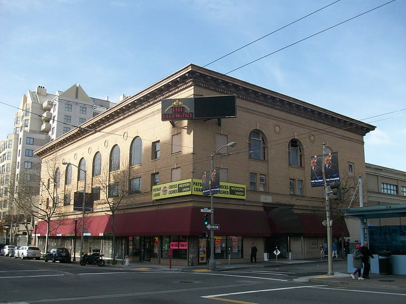
Nearby attractions include: Great American Music Hall, The Regency Ballroom, San Francisco City Hall, The Fillmore.


Frequently Asked Questions (FAQ)
Which popular attractions are close to Cathedral of Saint Mary of the Assumption?
Nearby attractions include St. Mark's Lutheran Church, San Francisco (3 min walk), Fillmore District, San Francisco (6 min walk), National Japanese American Historical Society, San Francisco (7 min walk), Japan Center, San Francisco (8 min walk).
How to get to Cathedral of Saint Mary of the Assumption by public transport?
The nearest stations to Cathedral of Saint Mary of the Assumption:
Bus
Trolleybus
Tram
Light rail
Metro
Bus
- Starr King Way & Gough Street • Lines: 38 (3 min walk)
- Geary Boulevard & Laguna Street • Lines: 38, 38R (5 min walk)
Trolleybus
- Fillmore Street & O'Farrell Street • Lines: 22 (11 min walk)
Tram
- California Street & Van Ness Avenue (13 min walk)
- California Street & Polk Street (14 min walk)
Light rail
- Van Ness • Lines: K, N, S, T (18 min walk)
- Civic Center • Lines: K, N, S, T (18 min walk)
Metro
- Civic Center • Lines: Blue, Green, Red, Yellow (18 min walk)
- Powell Street • Lines: Blue, Green, Red, Yellow (25 min walk)