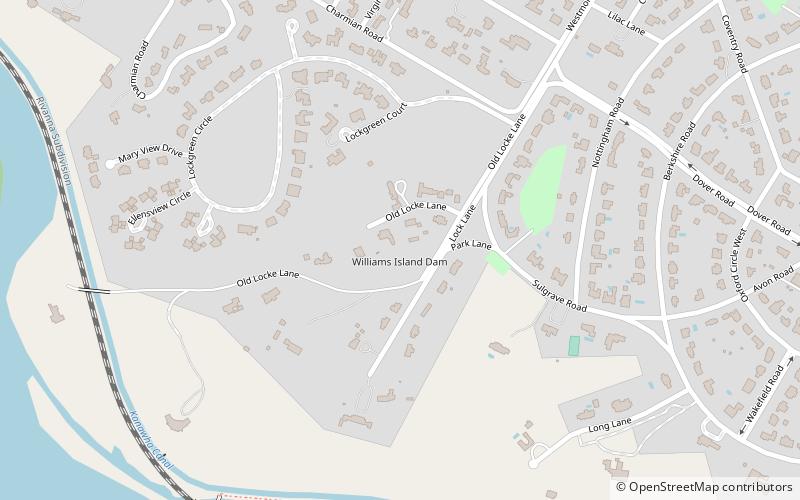
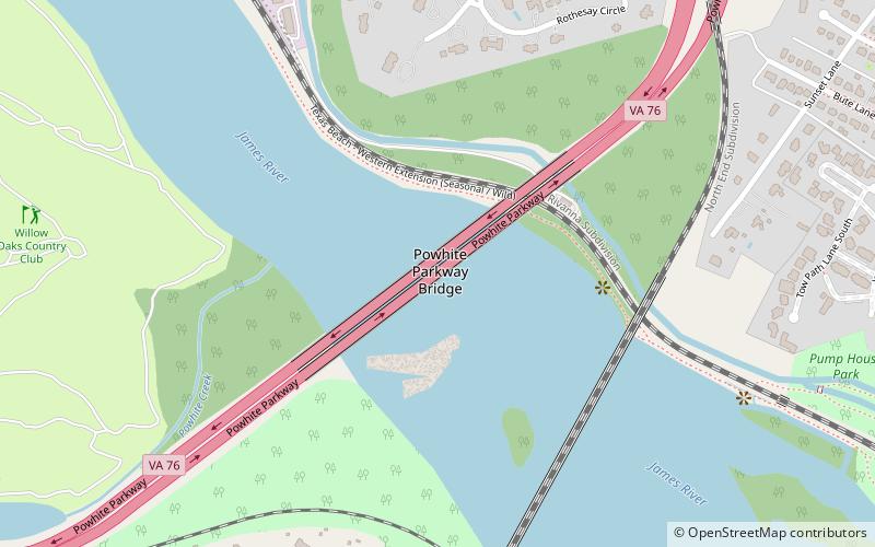
Williams Island Dam, Richmond
Map
Facts and practical information
Williams Island Dam is located on the James River in the independent city of Richmond, Virginia. Just below the dam, seven miles of rapids mark the descent of the river downstream through the geological Fall Line region to the navigable tidal portion below Richmond, which extends southeast to Hampton Roads. ()
Coordinates: 37°33'25"N, 77°30'35"W
Address
Near West End (Wilton)Richmond
ContactAdd
Social media
Add
Getting there by public transportation
Public transportation stops near this location
- Bus
 Bus
Bus
- Calculate routePatterson + Malvern 33 min walk
Day trips


Frequently Asked Questions (FAQ)
Which popular attractions are close to Williams Island Dam?
Nearby attractions include Lockgreen, Richmond (7 min walk), Agecroft Hall, Richmond (10 min walk), Virginia House, Richmond (11 min walk), Windsor Farms, Richmond (14 min walk).
How to get to Williams Island Dam by public transport?
The nearest stations to Williams Island Dam:
Bus
Bus
- Patterson + Malvern • Lines: 76 (33 min walk)