Pettigru Street Historic District, Greenville

Gallery (1)
Map
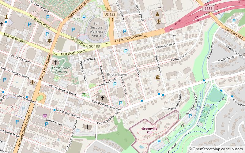
Map
Facts and practical information
Pettigru Street Historic District is a historic tree-lined neighborhood east of Main Street in downtown Greenville, South Carolina. It is home to 88 structures built between 1890 and 1930 with the majority built between 1910 and 1930. It is known for its wide variety of architectural styles including Queen Anne, Colonial Revival, and Bungalow. The area is an example of evolution of architectural style from the Victorian era to the early 1930s similar to the growth in the city of Greenville as a whole during that time. ()
Coordinates: 34°50'60"N, 82°23'23"W
Address
Central Greenville (Pettigru Historic District)Greenville
ContactAdd
Social media
Add
Getting there by public transportation
Public transportation stops near this location
- Bus
 Bus
Bus
- Calculate routeWashington St @ Toy Street 4 min walk
- Calculate routeGreenville Zoo 9 min walk
- Calculate routeMcBee Station 9 min walk
Day trips


Frequently Asked Questions (FAQ)
Which popular attractions are close to Pettigru Street Historic District?
Nearby attractions include Museum & Library of Confederate History, Greenville (4 min walk), Bon Secours Wellness Arena, Greenville (6 min walk), Christ Church, Greenville (7 min walk), Greenville Zoo, Greenville (8 min walk).
How to get to Pettigru Street Historic District by public transport?
The nearest stations to Pettigru Street Historic District:
Bus
Bus
- Washington St @ Toy Street • Lines: 1A, 8H (4 min walk)
- Greenville Zoo • Lines: 1A, 8H (9 min walk)