Shaare Zedek Synagogue, St. Louis
Map
Facts and practical information
Shaare Zedek Synagogue was a Conservative Jewish synagogue founded in 1905 in St. Louis, Missouri, United States. In 2013 the synagogue merged with Brith Sholom Kneseth Israel synagogue in St. Louis, Missouri to become Kol Rinah. ()
Coordinates: 38°39'48"N, 90°19'59"W
Getting there by public transportation
Public transportation stops near this location
- Bus
- Light rail
 Bus
Bus
- Calculate routeForsyth 27 min walk
- Calculate routeUniversity City-Big Bend 33 min walk
- Calculate routeDelmar at Big Bend EB 29 min walk
- Calculate routeBig Bend at Kingsbury NB 31 min walk
- Calculate routeForest Park Parkway at Big Bend WB 33 min walk
- Calculate route560 Music Center Loop at Washington 33 min walk
Day trips


Frequently Asked Questions (FAQ)
Which popular attractions are close to Shaare Zedek Synagogue?
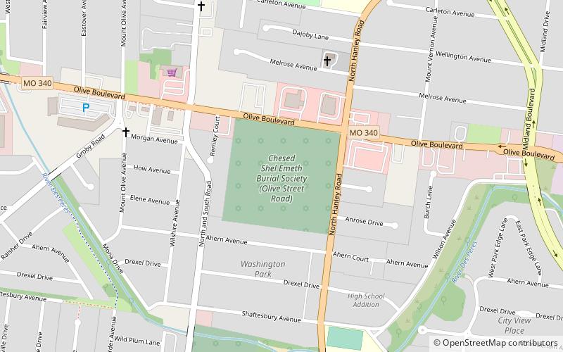
Nearby attractions include University City, St. Louis (13 min walk), Chesed Shel Emeth Cemetery, St. Louis (13 min walk), Beverly Theater, St. Louis (17 min walk), Metropolitan Zoological Park and Museum District, St. Louis (24 min walk).
How to get to Shaare Zedek Synagogue by public transport?
The nearest stations to Shaare Zedek Synagogue:
Light rail
Bus
Light rail
- Forsyth • Lines: Blue (27 min walk)
- University City-Big Bend • Lines: Blue (33 min walk)
Bus
- Delmar at Big Bend EB • Lines: 5 (29 min walk)
- Big Bend at Kingsbury NB • Lines: 5 (31 min walk)