Soldiers Field Road, Belmont
Map
Facts and practical information
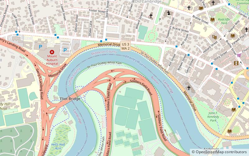
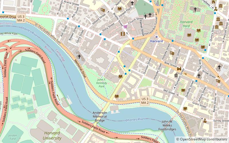
Soldiers Field Road is a major crosstown parkway in Boston, Massachusetts, running west to east from U.S. Route 20 in the northwest corner of Brighton to the Boston University Bridge. It follows the course of the Charles River and also passes by the campuses of Harvard University and Boston University. The road is named for the area south of the road on a bend in the Charles River which has been the home of Harvard Crimson athletics since the 1890s. ()
Coordinates: 42°22'22"N, 71°7'45"W
Address
AllstonBelmont
ContactAdd
Social media
Add
Getting there by public transportation
Public transportation stops near this location
- Metro
- Bus
- Train
 Metro
Metro
- Calculate routeHarvard Square 14 min walk
- Calculate routeMassachusetts Ave @ Holyoke St 15 min walk
- Calculate routeMt Auburn St @ DeWolfe St 18 min walk
- Calculate routeHarvard 14 min walk
- Calculate routePorter 32 min walk
- Calculate routePorter 31 min walk
Day trips
Soldiers Field Road – popular in the area (distance from the attraction)
Nearby attractions include: Bright-Landry Hockey Center, Brattle Theatre, Longfellow House–Washington's Headquarters National Historic Site, Anderson Memorial Bridge.


Frequently Asked Questions (FAQ)
Which popular attractions are close to Soldiers Field Road?
Nearby attractions include Memorial Drive Apartments Historic District, Belmont (5 min walk), Eliot Bridge, Boston (6 min walk), Building at 259 Mount Auburn Street, Belmont (6 min walk), Conventual Church of St. Mary and St. John, Belmont (6 min walk).
How to get to Soldiers Field Road by public transport?
The nearest stations to Soldiers Field Road:
Bus
Metro
Train
Bus
- Harvard Square (14 min walk)
- Massachusetts Ave @ Holyoke St • Lines: 1, 69 (15 min walk)
Metro
- Harvard • Lines: Red (14 min walk)
- Porter • Lines: Red (32 min walk)
Train
- Porter (31 min walk)