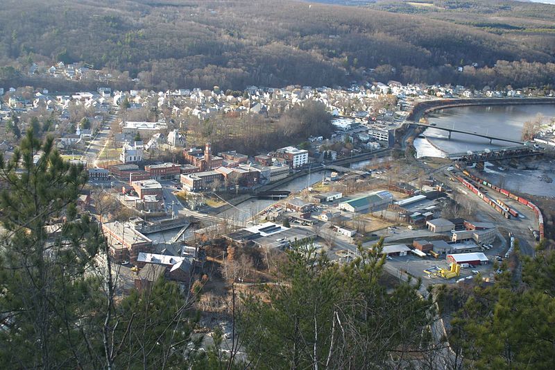
Bellows Falls Canal, Bellows Falls
Map

Gallery

Facts and practical information
Bellows Falls Canal is a canal constructed to allow boat traffic to bypass Great Falls on the Connecticut River in Bellows Falls, Vermont. It was constructed by the Bellows Falls Canal Company and was one of the first canals in the United States. It was used for transport, to power mills, and later for hydroelectric power. The Bellows Falls Downtown Historic District includes the canal. ()
Coordinates: 43°8'2"N, 72°26'34"W
Address
7 SquareRockinghamBellows Falls
ContactAdd
Social media
Add
Day trips
Bellows Falls Canal – popular in the area (distance from the attraction)
Nearby attractions include: Bellows Falls Opera House, Vilas Bridge, Arch Bridge, Rockingham Free Public Library.
Frequently Asked Questions (FAQ)
Which popular attractions are close to Bellows Falls Canal?
Nearby attractions include Moore and Thompson Paper Mill Complex, Bellows Falls (1 min walk), Bellows Falls Tunnel, Bellows Falls (2 min walk), Bellows Falls Opera House, Bellows Falls (3 min walk), Vilas Bridge, Bellows Falls (5 min walk).
How to get to Bellows Falls Canal by public transport?
The nearest stations to Bellows Falls Canal:
Train
Train
- Bellows Falls (6 min walk)


