Queens West, New York City
Map

Gallery
Facts and practical information
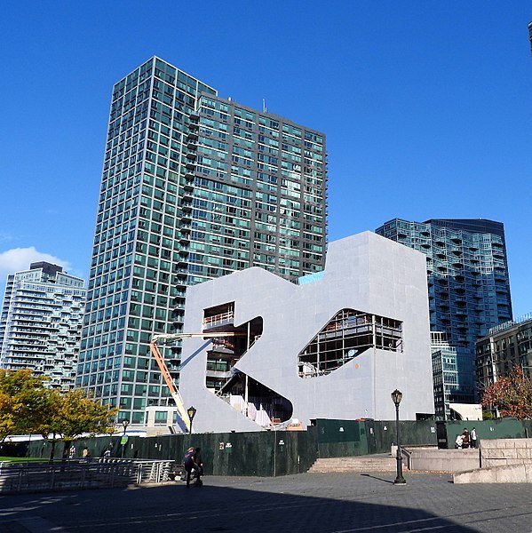
Queens West is a district and redevelopment project along the East River in Long Island City, Queens, New York City. The project, located on Hunter's Point south of the Anable Basin, is a joint project sponsored by the Port Authority of New York & New Jersey and the Empire State Development Corporation. The Queens West Development Corporation, a subsidiary of ESD, was established in 1992 to facilitate implementation of the approved development plan. ()
Coordinates: 40°44'43"N, 73°57'32"W
Address
Northwestern Queens (Long Island City)New York City
ContactAdd
Social media
Add
Day trips
Queens West – popular in the area (distance from the attraction)
Nearby attractions include: Church Center for the United Nations, United Nations Headquarters, MoMA PS1, 5 Pointz.
Frequently Asked Questions (FAQ)
Which popular attractions are close to Queens West?
Nearby attractions include Gantry Plaza State Park, New York City (2 min walk), Water Taxi Beach, New York City (7 min walk), U Thant Island, New York City (8 min walk), Franklin D. Roosevelt Four Freedoms Park, New York City (10 min walk).
How to get to Queens West by public transport?
The nearest stations to Queens West:
Train
Bus
Metro
Train
- Long Island City (8 min walk)
- Hunterspoint Avenue (17 min walk)
Bus
- Vernon Boulevard & 50th Avenue • Lines: Q103 (8 min walk)
- East 42nd Street & 1st Avenue • Lines: M42 (15 min walk)
Metro
- Vernon Boulevard–Jackson Avenue • Lines: <7>, 7 (9 min walk)
- 21st Street • Lines: G (13 min walk)

 Subway
 Manhattan Buses
