Wallace Butte, Grand Canyon National Park
Map

Map

Facts and practical information
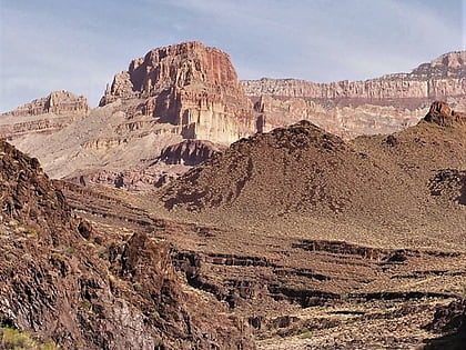
Wallace Butte is a 5,209-foot -elevation summit located in western Grand Canyon, in Coconino County of northern Arizona, United States. It is located on the South Rim, about 1.0 mile northwest of the Grand Scenic Divide across Bass Canyon. Wallace Butte is 1.73 miles northeast of Mount Huethawali, and the butte lies about 3/4 mile south of the west-flowing Colorado River. ()
Coordinates: 36°12'45"N, 112°22'22"W
Address
Grand Canyon National Park
ContactAdd
Social media
Add
Day trips
Wallace Butte – popular in the area (distance from the attraction)
Nearby attractions include: Fan Island, Holy Grail Temple, Royal Arch Route, Evans Butte.


