Proctor-Hopson Circle, New York City
Facts and practical information
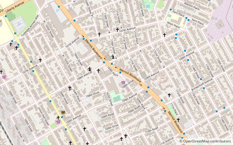
Proctor-Hopson Circle is a semicircular traffic mall in the neighborhood of South Jamaica, Queens acquired by the city for park purposes in 1924 following the widening of Merrick Boulevard. After this road was straightened in 1924, its former route became 169th Place. In 1932, the semicircular traffic island was named after two local residents who were killed in the First World War. John Proctor and James Hopson were members of the 369th Infantry of the National Guard, known informally as the Harlem Hellfighters. Among the first in the unit from Queens to die in this war were Proctor and Hopson. In their memory, the local Veterans of Foreign Wars chapter is named the Procter-Hopson Post No. 1896. ()
Southeastern Queens (Jamaica)New York City
- Metro
- Bus
- Light rail
- Train
 Metro
Metro
- Calculate routeMerrick Boulevard & 104th Avenue 9 min walk
- Calculate routeArcher Avenue & Merrick Boulevard 15 min walk
- Calculate routeMerrick Boulevard & Archer Avenue 15 min walk
- Calculate routeJamaica Center–Parsons/Archer 21 min walk
- Calculate route169th Street 25 min walk
- Calculate routeJamaica 29 min walk
- Calculate routeSt. Albans 30 min walk
- Calculate routeHollis 34 min walk
- Calculate routeJamaica 30 min walk
 SubwayMaps
 Manhattan Buses


Frequently Asked Questions (FAQ)
Which popular attractions are close to Proctor-Hopson Circle?
How to get to Proctor-Hopson Circle by public transport?
Bus
- Merrick Boulevard & 104th Avenue • Lines: n4 (9 min walk)
- Archer Avenue & Merrick Boulevard • Lines: n4 (15 min walk)
Metro
- Jamaica Center–Parsons/Archer • Lines: E, J, Z (21 min walk)
- 169th Street • Lines: <F>, F (25 min walk)
Train
- Jamaica (29 min walk)
- St. Albans (30 min walk)
Light rail
- Jamaica • Lines: Jfk (30 min walk)