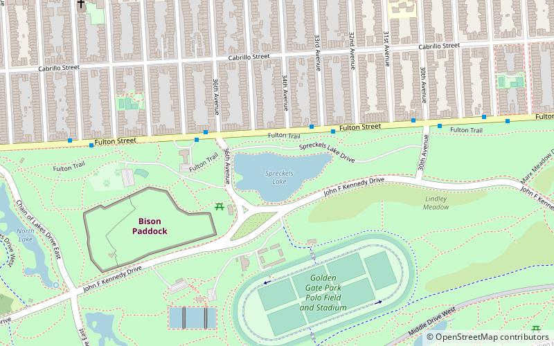
Spreckels Lake, San Francisco
Facts and practical information
The Spreckels Lake Model Yacht Facility, commonly referred to as "Spreckels Lake", is an artificial reservoir behind an earthen dam and adjoining clubhouse situated on the northern side of San Francisco's Golden Gate Park. Completed in mid-March 1904, the reservoir was built for the use of model boaters of all ages, interests, and skill levels, designed specifically for racing model sail and power boats and to propagate the skills and crafts necessary to build and sail competitive model boats of all types. The Spreckels Lake Model Yacht Facility is considered one of the finest examples and one of the most beautiful of the naturalistically styled, man-made model boating facilities in the world and is always open to anyone wishing to sail its waters with few restrictions. The facility is also the permanent home to the San Francisco Model Yacht Club, the organization at whose request Spreckels Lake and the adjoining clubhouses were built and whose history is and always will be irrevocably intertwined with the history of the facility. ()
Northwest San Francisco (Golden Gate Park)San Francisco
- Bus
- Trolleybus
- Light rail
- Train
 Bus
Bus
- Calculate routeFulton Street & 33rd Avenue 3 min walk
- Calculate routeGeary Boulevard & 33rd Avenue 16 min walk
- Calculate route33rd Avenue & Clement Street 19 min walk
- Calculate route32nd Avenue & Clement Street 20 min walk
- Calculate routeJudah Street & 34th Avenue 18 min walk
- Calculate routeJudah Street & La Playa Street 28 min walk
- Calculate routeJudah Street & 19th Avenue 30 min walk
 Muni Metro


Frequently Asked Questions (FAQ)
Which popular attractions are close to Spreckels Lake?
How to get to Spreckels Lake by public transport?
Bus
- Fulton Street & 33rd Avenue • Lines: 5 (3 min walk)
Trolleybus
- Geary Boulevard & 33rd Avenue • Lines: 1 (16 min walk)
- 33rd Avenue & Clement Street • Lines: 1 (19 min walk)
Light rail
- Judah Street & 34th Avenue • Lines: N (18 min walk)
Train
- Judah Street & La Playa Street (28 min walk)
- Judah Street & 19th Avenue (30 min walk)