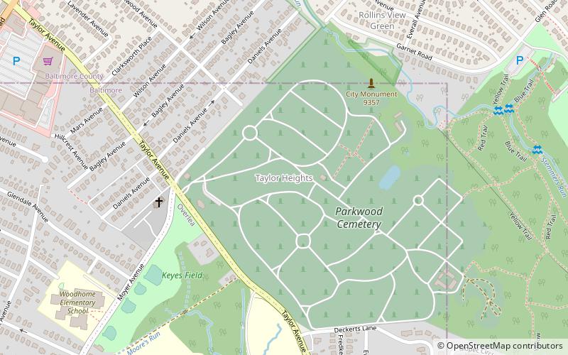
Taylor Heights, Baltimore
Map
Facts and practical information
Taylor Heights is a neighborhood in northeast Baltimore. The neighborhood contains only a few homes because Parkwood Cemetery takes up much of the neighborhood. A major road in the neighborhood is Taylor Avenue, which runs from Overlea in the east to Towson in the west, at which point it becomes Goucher Boulevard/Hillen Road. ()
Coordinates: 39°22'11"N, 76°32'5"W
Address
Northeastern Baltimore (Taylor Heights)Baltimore
ContactAdd
Social media
Add
Getting there by public transportation
Public transportation stops near this location
- Bus
 Bus
Bus
- Calculate routeNorthern Parkway & Hilltop Avenue Westbound 21 min walk
Day trips


Frequently Asked Questions (FAQ)
How to get to Taylor Heights by public transport?
The nearest stations to Taylor Heights:
Bus
Bus
- Northern Parkway & Hilltop Avenue Westbound • Lines: 33, 36 (21 min walk)