Anderson Ferry, Cincinnati

Gallery (2)
Map

Map
Gallery
Facts and practical information
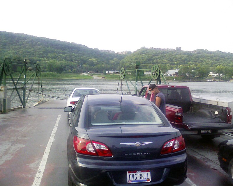
The Anderson Ferry is a ferry across the Ohio River between Cincinnati, Ohio and Constance, Kentucky. It has been in continuous operation since 1817. It was originated by George W Anderson the founder of the business, sold to the Kottmyer family then known as the Kotmeyer ferry and was later sold back to the Anderson family in 1986. The ferry was often used in the 19th century by Kentucky farmers bringing their product to market in Cincinnati. It is the lone survivor of dozens of ferries that once served the Cincinnati area. The ferry is located about 8 miles west of Downtown Cincinnati. ()
Coordinates: 39°4'35"N, 84°37'28"W
Address
Sayler ParkCincinnati
ContactAdd
Social media
Add
Getting there by public transportation
Public transportation stops near this location
- Bus
 Bus
Bus
- Calculate routeAnderson Ferry 2 min walk
- Calculate routeRiver Rd 4287 6 min walk
Day trips


Frequently Asked Questions (FAQ)
How to get to Anderson Ferry by public transport?
The nearest stations to Anderson Ferry:
Bus
Bus
- Anderson Ferry • Lines: 50 (2 min walk)
- River Rd 4287 • Lines: 50 (6 min walk)