Mount Winans, Baltimore
Map

Map

Facts and practical information
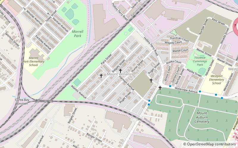
"Mount Winans" is a mixed-use residential, commercial and industrial neighborhood in the southwestern area of the City of Baltimore in Maryland. Its north, south and east boundaries are marked by the various lines of track of the CSX Railroad. In addition, Hollins Ferry Road running to the south towards suburban Baltimore County in the southwest and further connecting with adjacent Anne Arundel County to the southeast, draws its western boundary. ()
Coordinates: 39°15'43"N, 76°38'41"W
Address
Southern Baltimore (Mount Winans)Baltimore
ContactAdd
Social media
Add
Day trips
Mount Winans – popular in the area (distance from the attraction)
Nearby attractions include: M&T Bank Stadium, Mount Clare, Carroll Park, Mount Auburn Cemetery.
Frequently Asked Questions (FAQ)
Which popular attractions are close to Mount Winans?
Nearby attractions include Mount Auburn Cemetery, Baltimore (9 min walk), Westport, Baltimore (13 min walk).
How to get to Mount Winans by public transport?
The nearest stations to Mount Winans:
Light rail
Bus
Light rail
- Cherry Hill • Lines: Lr (17 min walk)
- Westport • Lines: Lr (18 min walk)
Bus
- Greyhound Baltimore Downtown Bus Station (30 min walk)


