Charlotte Allen Fountain, Houston
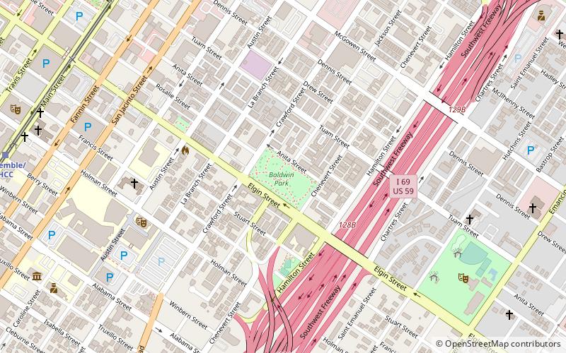
Map
Facts and practical information
The Charlotte Allen Fountain is a 1912 limestone fountain by an unknown artist, installed in Elizabeth Baldwin Park, Houston, in the U.S. state of Texas. The fountain commemorates Charlotte Baldwin Allen, the wife of the city's founder, Augustus Chapman Allen. According to the Houston Parks and Recreation Department, the fountain once had a centerpiece, and "there are no records of its purchase or installation". ()
Coordinates: 29°44'19"N, 95°22'14"W
Address
South Central Houston (Midtown)Houston
ContactAdd
Social media
Add
Getting there by public transportation
Public transportation stops near this location
- Bus
- Light rail
 Bus
Bus
- Calculate routeEnsemble/HCC 13 min walk
- Calculate routeMcGowen 14 min walk
- Calculate routeDowntown Transit Center 21 min walk
- Calculate routeWheeler 22 min walk
- Calculate routeGreyhound Bus Lines 17 min walk
- Calculate routeDowntown Transit Center 21 min walk
- Calculate routeWheeler Station Transit Center 22 min walk
- Calculate routeFlixBus Houston 23 min walk
Day trips


Frequently Asked Questions (FAQ)
Which popular attractions are close to Charlotte Allen Fountain?
Nearby attractions include Congregation Beth Israel, Houston (7 min walk), First Evangelical Church, Houston (9 min walk), Emancipation Park, Houston (10 min walk), Station Museum of Contemporary Art, Houston (10 min walk).
How to get to Charlotte Allen Fountain by public transport?
The nearest stations to Charlotte Allen Fountain:
Light rail
Bus
Light rail
- Ensemble/HCC • Lines: Red (13 min walk)
- McGowen • Lines: Red (14 min walk)
Bus
- Greyhound Bus Lines (17 min walk)
- Downtown Transit Center (21 min walk)