Evelyn Moakley Bridge, Boston
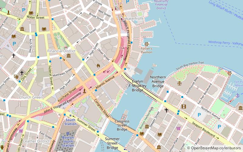
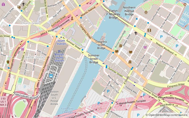
Map
Facts and practical information
The Evelyn Moakley Bridge is a bridge that connects Downtown Boston to the Seaport District. It was named for the late wife of Congressman Joe Moakley shortly after her death. At the eastern end of the bridge is the John Joseph Moakley Federal Courthouse and the Seaport Shrine. ()
Coordinates: 42°21'16"N, 71°3'5"W
Getting there by public transportation
Public transportation stops near this location
- Metro
- Bus
- Light rail
- Train
 Metro
Metro
- Calculate routeSouth Station 6 min walk
- Calculate routeAquarium 9 min walk
- Calculate routeState 11 min walk
- Calculate routeDowntown Crossing 12 min walk
- Calculate routeFederal St @ Franklin St 7 min walk
- Calculate routeSummer St opp Melcher St 8 min walk
- Calculate routeOtis St @ Summer St 10 min walk
- Calculate routeLincoln St @ Essex St 10 min walk
- Calculate routeBoston South Station 8 min walk
- Calculate routeBoston North Station 26 min walk
- Calculate routeGovernment Center 14 min walk
- Calculate routePark Street 15 min walk
- Calculate routeHaymarket 16 min walk
- Calculate routeBoylston 18 min walk
Maps MBTA Subway
MBTA SubwayDay trips


Frequently Asked Questions (FAQ)
Which popular attractions are close to Evelyn Moakley Bridge?
Nearby attractions include Northern Avenue Bridge, Boston (3 min walk), 125 High Street, Boston (3 min walk), Gridley Street Historic District, Boston (4 min walk), Children's Wharf Park, Boston (5 min walk).
How to get to Evelyn Moakley Bridge by public transport?
The nearest stations to Evelyn Moakley Bridge:
Metro
Bus
Train
Light rail
Metro
- South Station • Lines: Red (6 min walk)
- Aquarium • Lines: Blue (9 min walk)
Bus
- Federal St @ Franklin St • Lines: 504 (7 min walk)
- Summer St opp Melcher St • Lines: 7 (8 min walk)
Train
- Boston South Station (8 min walk)
- Boston North Station (26 min walk)
Light rail
- Government Center • Lines: C, D, E (14 min walk)
- Park Street • Lines: B, C, D, E (15 min walk)