Lower South Providence, Providence
Map
Facts and practical information
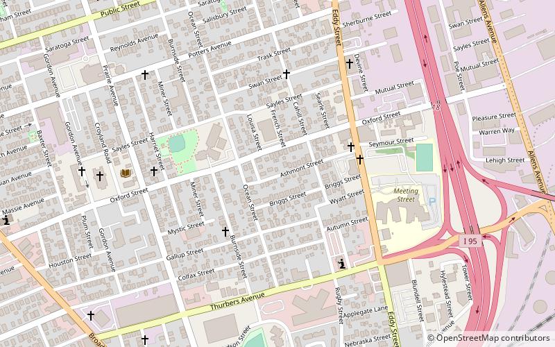
The Lower South Side is a neighborhood in the southern part of Providence, Rhode Island. It is bounded by Public Street to the north, by Interstate 95 to the south, by Broad Street to the west, and by the Providence River to the east. ()
Coordinates: 41°48'7"N, 71°24'32"W
Address
Lower South ProvidenceProvidence
ContactAdd
Social media
Add
Getting there by public transportation
Public transportation stops near this location
- Bus
 Bus
Bus
- Calculate routeEddy and Borden 18 min walk
- Calculate routePontiac and Richfield 41 min walk
Day trips


Frequently Asked Questions (FAQ)
Which popular attractions are close to Lower South Providence?
Nearby attractions include Calvary Baptist Church, Providence (4 min walk), South Providence Library-Providence Community Library, Providence (6 min walk), St. Michael's Roman Catholic Church, Providence (7 min walk), Big Blue Bug, Providence (11 min walk).
How to get to Lower South Providence by public transport?
The nearest stations to Lower South Providence:
Bus
Bus
- Eddy and Borden • Lines: 3, 3A, 3B (18 min walk)
- Pontiac and Richfield • Lines: 21 (41 min walk)