Colonial Place, Norfolk
Map

Map

Facts and practical information
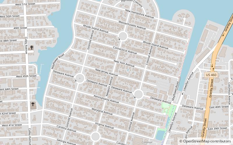
Colonial Place is a residential neighborhood in Norfolk, Virginia. It is a peninsula bordered by 38th Street on the south, and surrounded on three sides by the Lafayette River. It is a relatively racially mixed area that includes mostly single family homes and a few apartment buildings. Many large homes front the water and Mayflower Road arches around the shore of the river. ()
Coordinates: 36°53'7"N, 76°17'18"W
Address
Colonial PlaceNorfolk
ContactAdd
Social media
Add
Day trips
Colonial Place – popular in the area (distance from the attraction)
Nearby attractions include: Virginia Zoo, Chartway Arena, Mermaid Factory, Saint Mary's Catholic Cemetery.
Frequently Asked Questions (FAQ)
Which popular attractions are close to Colonial Place?
Nearby attractions include ODU Baron and Ellin Gordon Art Galleries, Norfolk (18 min walk), Virginia Zoo, Norfolk (21 min walk), Saint Mary's Catholic Cemetery, Norfolk (23 min walk), Norfolk and Western Railroad Historic District, Norfolk (23 min walk).
How to get to Colonial Place by public transport?
The nearest stations to Colonial Place:
Train
Train
- Goode (19 min walk)
- Beazley (22 min walk)


