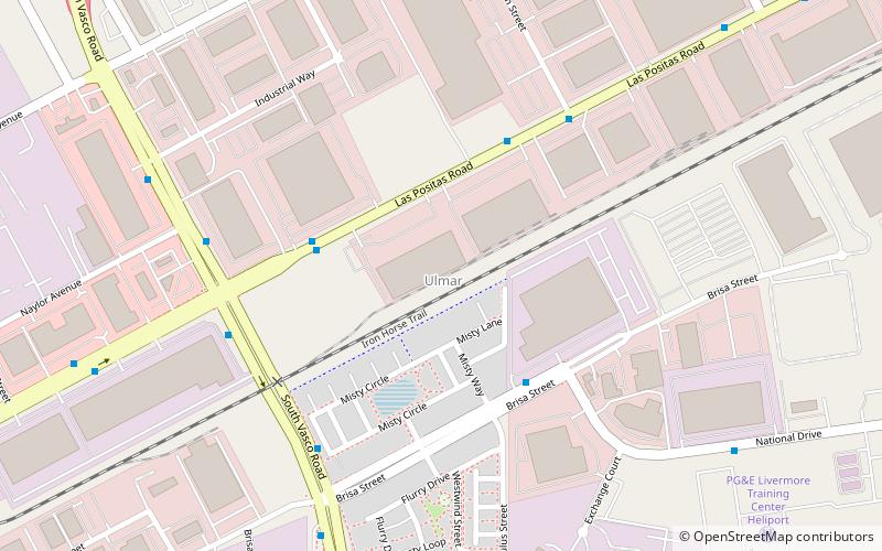
Ulmar, Livermore
Map
Facts and practical information
Ulmar is a former unincorporated community now annexed to Livermore in Alameda County, California. It lies at an elevation of 551 feet. It holds the Livermore National labator ()
Coordinates: 37°42'11"N, 121°42'58"W
Address
UlmarLivermore
ContactAdd
Social media
Add
Getting there by public transportation
Public transportation stops near this location
- Bus
- Train
 Bus
Bus
- Calculate routeLas Positas Road & South Vasco Road 4 min walk
- Calculate routeBrisa Street & National Drive 4 min walk
- Calculate routeKaiser Depot 5 min walk
- Calculate routeVasco Road 11 min walk
Day trips


Frequently Asked Questions (FAQ)
How to get to Ulmar by public transport?
The nearest stations to Ulmar:
Bus
Train
Bus
- Las Positas Road & South Vasco Road • Lines: 11 (4 min walk)
- Brisa Street & National Drive • Lines: 11 (4 min walk)
Train
- Vasco Road (11 min walk)