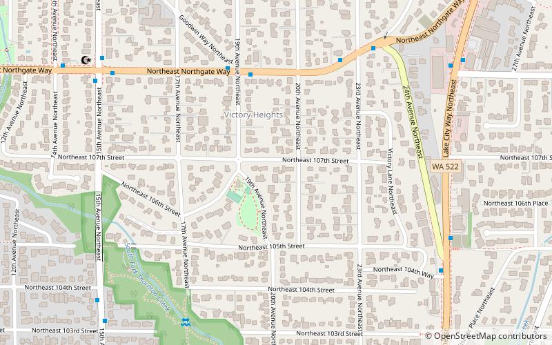
Victory Heights, Seattle
Map
Facts and practical information
Victory Heights is a neighborhood in the Lake City district of Seattle, Washington. It was named after the Victory Highway, which formed the eastern border of the area. The highway was originally called the Gerhart Erickson Road, the namesake of which was Gerhart Erickson, who sponsored the Good Roads legislation in 1903. The road was then renamed Bothell Road, changed to Victory Highway in 1924, before returning to Bothell Road; it is now called Lake City Way NE. The neighborhood was annexed to the city of Seattle in 1954. ()
Coordinates: 47°42'23"N, 122°18'25"W
Address
Lake City (Victory Heights)Seattle
ContactAdd
Social media
Add
Getting there by public transportation
Public transportation stops near this location
- Bus
- Light rail
 Bus
Bus
- Calculate routeNE Northgate Way & 19th Ave NE 4 min walk
- Calculate routeLake City Way NE & 24th Ave NE 7 min walk
- Calculate route15th Ave NE & NE Northgate Way 8 min walk
- Calculate routeNorthgate 26 min walk
Day trips


Frequently Asked Questions (FAQ)
Which popular attractions are close to Victory Heights?
Nearby attractions include Washington's 46th legislative district, Seattle (14 min walk), Maple Leaf, Seattle (19 min walk).
How to get to Victory Heights by public transport?
The nearest stations to Victory Heights:
Bus
Light rail
Bus
- NE Northgate Way & 19th Ave NE • Lines: 20 (4 min walk)
- Lake City Way NE & 24th Ave NE • Lines: 372 (7 min walk)
Light rail
- Northgate • Lines: 1 (26 min walk)