Wedgwood, Seattle
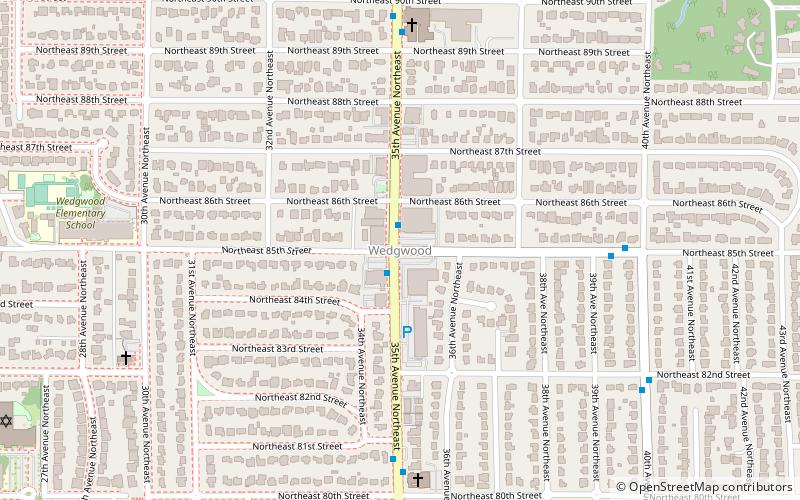
Map
Facts and practical information
Wedgwood is a middle class residential neighborhood of northeast Seattle, Washington with a modest commercial strip. Wedgwood is located about two miles north, and slightly east, of the University of Washington; it is about six miles northeast of Downtown. The neighborhood is further typical of Seattle neighborhoods in having more than one name and having different, overlapping, but well-documented definitions of the neighborhood. ()
Coordinates: 47°41'25"N, 122°17'26"W
Address
Northeast Seattle (Wedgwood)Seattle
ContactAdd
Social media
Add
Getting there by public transportation
Public transportation stops near this location
- Bus
 Bus
Bus
- Calculate route35th Ave NE & NE 85th St 1 min walk
Day trips


Frequently Asked Questions (FAQ)
Which popular attractions are close to Wedgwood?
Nearby attractions include Picardo Farm, Seattle (13 min walk), Burke–Gilman Trail, Seattle (18 min walk), Wedgwood Rock, Seattle (19 min walk), Washington's 46th legislative district, Seattle (21 min walk).
How to get to Wedgwood by public transport?
The nearest stations to Wedgwood:
Bus
Bus
- 35th Ave NE & NE 85th St • Lines: 64, 65 (1 min walk)