Doyle Community Park, Santa Rosa
Map
Facts and practical information
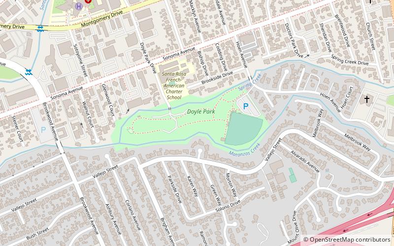
Doyle Community Park is an urban park on the eastern edge of downtown Santa Rosa, California. The western end of the park is the confluence of Matanzas Creek and Spring Creek. Spring Creek forms the northern park boundary and Matanzas Creek forms the southern park boundary. The eastern end of the park is a fenced and lighted baseball field formerly used by the minor league Santa Rosa Pirates. The remainder of the park includes the Doyle Park Clubhouse, restrooms, playground slides and swings, horseshoe pits, separate fenced areas for unleashed large and small dogs, and picnic tables with barbecue grills including five sites available for reservation. ()
Elevation: 180 ft a.s.l.Coordinates: 38°26'23"N, 122°41'46"W
Address
Santa Rosa
ContactAdd
Social media
Add
Getting there by public transportation
Public transportation stops near this location
- Bus
 Bus
Bus
- Calculate routeMaple Avenue & Brookwood Avenue 14 min walk
- Calculate routeMontgomery Village Transit Hub 17 min walk
- Calculate routeSanta Rosa Transit Mall Platform N1 25 min walk
- Calculate routeSanta Rosa Transit Mall 25 min walk
Day trips


Frequently Asked Questions (FAQ)
Which popular attractions are close to Doyle Community Park?
Nearby attractions include Cathedral of Saint Eugene, Santa Rosa (19 min walk), Sonoma County Fairgrounds, Santa Rosa (20 min walk), Sonoma County Library, Santa Rosa (21 min walk), McDonald Mansion, Santa Rosa (22 min walk).
How to get to Doyle Community Park by public transport?
The nearest stations to Doyle Community Park:
Bus
Bus
- Maple Avenue & Brookwood Avenue • Lines: 72, 72X (14 min walk)
- Montgomery Village Transit Hub (17 min walk)