Trek Zone

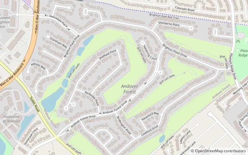
Andover Forest, Lexington

#98 among attractions in Lexington

Neighbourhood
Andover Forest location map
Map

Facts and practical information

Area: 0.46 mi²Coordinates: 38°0'32"N, 84°24'52"W
Address

Boone Creek (Andover Forest)Lexington United States

ContactAdd
Social media
Add
Day trips

Andover Forest – popular in the area (distance from the attraction)

Nearby attractions include: Hamburg Pavilion, Ashland, African Cemetery No. 2, Cathedral of Christ the King.

  • hamburg pavilion lexington location map
    0.9 miN
  • ashland lexington3.8 miW
  • african cemetery no 2 lexington4.5 miNW
  • cathedral of christ the king lexington4.1 miW
  • loudoun house lexington4.6 miNW
  • the salon at henry clay lexington3.4 miNW
  • walnut hill presbyterian church lexington location map
    2.8 miS
  • second presbyterian church lexington4.7 miNW
  • bell court lexington4.4 miNW
  • andover hills lexington location map
    0.9 miS
  • kenwick lexington location map
    3.7 miNW

Frequently Asked Questions (FAQ)

Which popular attractions are close to Andover Forest?

Nearby attractions include Autumn Ridge, Lexington (19 min walk), Andover Hills, Lexington (23 min walk).

Where to next? Visit kentucky Kentucky region page or discover the top tourist attractions in United States.