National Landing, Arlington


Facts and practical information
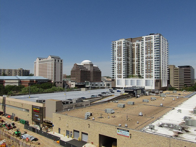
National Landing is an area in Northern Virginia encompassing parts of the Crystal City and Pentagon City neighborhoods of Arlington County and the Potomac Yard neighborhood in the city of Alexandria that has been announced as the location for Amazon.com, Inc.'s HQ2 headquarters project. While redevelopment efforts in the area had already begun as early as 2014, the cross-jurisdictional neighborhood was branded and announced as "National Landing" in 2018 as a part of local economic development plans to bring Amazon HQ2 to the area. The announcement also included plans to build a graduate-school satellite university campus of Virginia Tech in the area. The "National Landing" name derives, in part, from the area's proximity to Ronald Reagan Washington National Airport. ()
North Arlington (Buckingham)Arlington
- Metro
- Bus
 Metro
Metro
- Calculate routeArlington Blvd & Pershing Dr 4 min walk
- Calculate routeHenderson Rd & 3rd St N 4 min walk
- Calculate route2nd St N & Henderson Rd 4 min walk
- Calculate routeBallston–MU 22 min walk
- Calculate routeVirginia Square–GMU 26 min walk


Frequently Asked Questions (FAQ)
Which popular attractions are close to National Landing?
How to get to National Landing by public transport?
Bus
- Arlington Blvd & Pershing Dr • Lines: 4A (4 min walk)
- Henderson Rd & 3rd St N • Lines: 4B (4 min walk)
Metro
- Ballston–MU • Lines: Or, Sv (22 min walk)
- Virginia Square–GMU • Lines: Or, Sv (26 min walk)