Ridgeland Park, Atlanta
Map
Facts and practical information
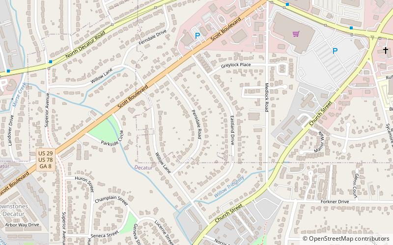
Ridgeland Park is a residential subdivision in Decatur, Georgia, USA containing a mix of older and newer homes. The neighborhood lies partly within the City Limits of Decatur and partly outside the city in unincorporated DeKalb County, Georgia. The streets include Willow Lane, Pensdale Road, Eastland Drive, Greylock Place, part of Scott Blvd and part of Medlock Rd. Ridgeland Park is bordered by Church Street to the south and Scott Boulevard to the north. ()
Coordinates: 33°47'20"N, 84°17'36"W
Address
North Decator (Ridgeland Park)Atlanta
ContactAdd
Social media
Add
Getting there by public transportation
Public transportation stops near this location
- Metro
- Bus
 Metro
Metro
- Calculate routeClairemont-Michigan 16 min walk
- Calculate routeClairmont Oaks 17 min walk
- Calculate routeDecatur 26 min walk
- Calculate routeAvondale 30 min walk
Day trips


Frequently Asked Questions (FAQ)
Which popular attractions are close to Ridgeland Park?
Nearby attractions include Woodlands Garden, Atlanta (16 min walk), Decatur Cemetery, Atlanta (17 min walk), Ponce de Leon Court Historic District, Atlanta (23 min walk).
How to get to Ridgeland Park by public transport?
The nearest stations to Ridgeland Park:
Bus
Metro
Bus
- Clairemont-Michigan • Lines: 19, Cctma (16 min walk)
- Clairmont Oaks • Lines: 19, Cctma (17 min walk)
Metro
- Decatur • Lines: Blue (26 min walk)
- Avondale • Lines: Blue, Green (30 min walk)