Talbot Avenue bridge, Silver Spring
Map
Facts and practical information
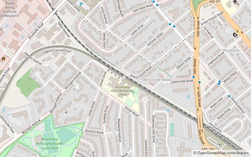
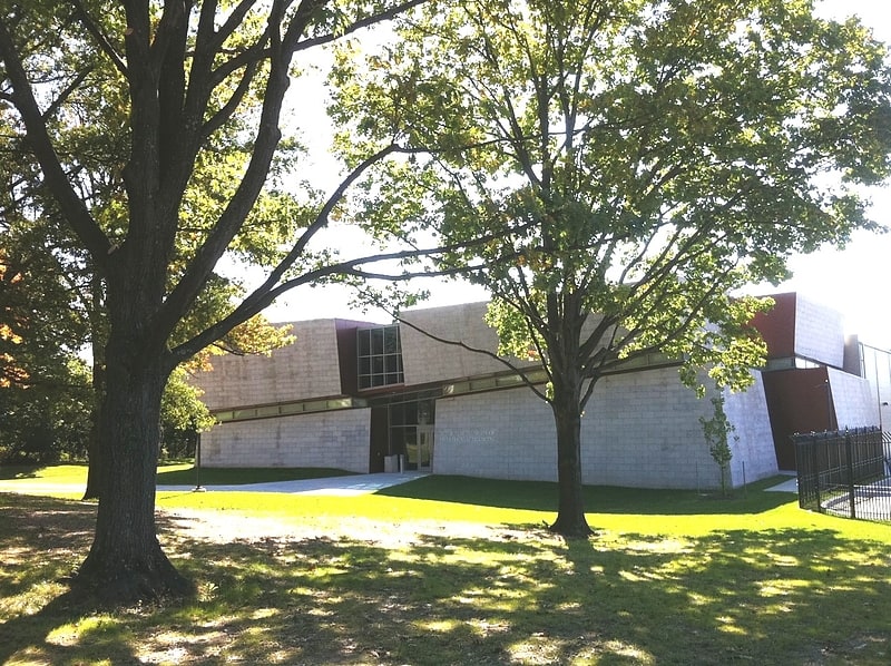
The Talbot Avenue bridge in Montgomery County, Maryland, was a historic one-lane metal girder bridge that connected Lyttonsville and downtown Silver Spring. Originally built in 1918, with a new deck added in 1986, it crossed the CSX railroad tracks between Hanover Street and Lanier Drive. It closed in June 2019, and was demolished later that year. It will be replaced by a new two-lane bridge, which is currently under construction. It will carry the Georgetown Branch Trail extension of the Capital Crescent Trail to Silver Spring. ()
Coordinates: 39°0'7"N, 77°2'42"W
Address
Silver SpringSilver Spring
ContactAdd
Social media
Add
Getting there by public transportation
Public transportation stops near this location
- Metro
- Bus
- Train
 Metro
Metro
- Calculate routeForest Glen 23 min walk
- Calculate routeSilver Spring 24 min walk
- Calculate routeD 25 min walk
- Calculate routeBay 105 25 min walk
- Calculate routeBay 218 25 min walk
- Calculate routeBay 222 25 min walk
- Calculate routeSilver Spring 26 min walk
Day trips


Frequently Asked Questions (FAQ)
Which popular attractions are close to Talbot Avenue bridge?
Nearby attractions include National Museum of Health and Medicine, Silver Spring (17 min walk), North Portal Estates, Washington D.C. (18 min walk), Rock Creek Gardens, Washington D.C. (24 min walk), National Park Seminary, Silver Spring (24 min walk).
How to get to Talbot Avenue bridge by public transport?
The nearest stations to Talbot Avenue bridge:
Metro
Bus
Train
Metro
- Forest Glen • Lines: Rd (23 min walk)
- Silver Spring • Lines: Rd (24 min walk)
Bus
- D • Lines: 7 (25 min walk)
- Bay 105 • Lines: 28 (25 min walk)
Train
- Silver Spring (26 min walk)