West Englewood, Chicago
Map
Facts and practical information
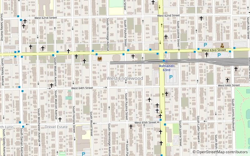
West Englewood, one of the 77 community areas, is on the southwest side of Chicago, Illinois. At one time it was known as South Lynne. The boundaries of West Englewood are Garfield Blvd to the north, Racine Ave to the east, the CSX and Norfolk Southern RR tracks to the west, and the Belt Railway of Chicago to the south. Though it is a separate community area, much of the history and culture of the neighborhood is linked directly to the Englewood neighborhood. ()
Area: 3.15 mi²Coordinates: 41°46'41"N, 87°40'0"W
Address
Southwest Side (West Englewood)Chicago
ContactAdd
Social media
Add
Getting there by public transportation
Public transportation stops near this location
- Metro
- Bus
 Metro
Metro
- Calculate route63rd Street & Paulina EB 3 min walk
- Calculate routeAshland/63rd 4 min walk
- Calculate routeHalsted 30 min walk
Maps Rail "L"
Rail "L"Day trips


Frequently Asked Questions (FAQ)
How to get to West Englewood by public transport?
The nearest stations to West Englewood:
Bus
Metro
Bus
- 63rd Street & Paulina EB • Lines: 63, (N) N63 (3 min walk)
Metro
- Ashland/63rd • Lines: Green (4 min walk)
- Halsted • Lines: Green (30 min walk)