Church of the River, Memphis
Map
Facts and practical information
The Church of the River, located in Memphis, Tennessee, is a member of the Unitarian Universalist Association, a liberal religious tradition. Services are held each Sunday at 11:00 a.m. ()
Coordinates: 35°7'38"N, 90°4'20"W
Address
Downtown Memphis (South Main)Memphis
ContactAdd
Social media
Add
Getting there by public transportation
Public transportation stops near this location
- Tram
- Train
 Tram
Tram
- Calculate routeMemphis Central Station 20 min walk
- Calculate routeCentral Station 21 min walk
- Calculate routeButler 23 min walk
- Calculate routeHuling Avenue 24 min walk
- Calculate routeHuling 25 min walk
Day trips


Frequently Asked Questions (FAQ)
Which popular attractions are close to Church of the River?
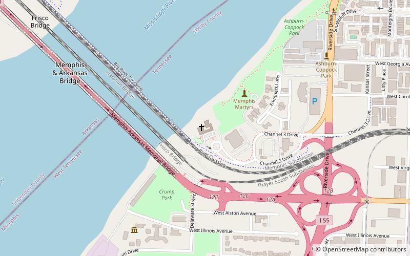
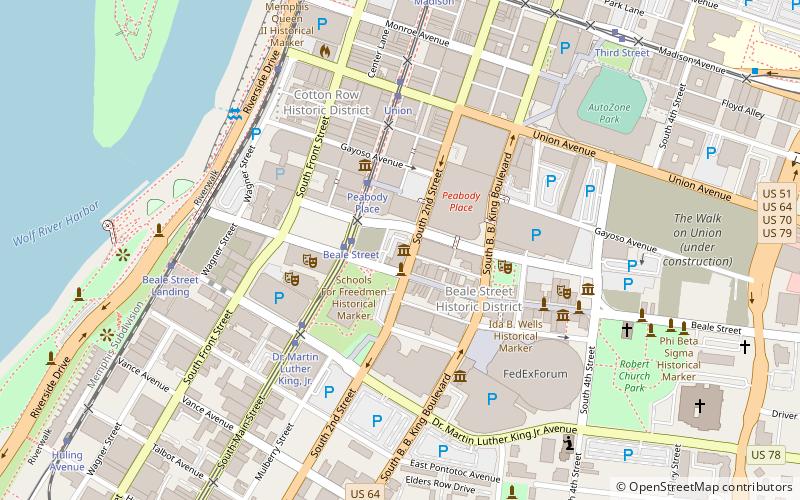
Nearby attractions include Big River Crossing, Memphis (6 min walk), Harahan Bridge, Memphis (6 min walk), Metal Museum, Memphis (8 min walk), Frisco Bridge, Memphis (12 min walk).
How to get to Church of the River by public transport?
The nearest stations to Church of the River:
Train
Tram
Train
- Memphis Central Station (20 min walk)
Tram
- Central Station • Lines: MATA Trolley Main Street Line, MATA Trolley Riverfront Loop (21 min walk)
- Butler • Lines: MATA Trolley Main Street Line, MATA Trolley Riverfront Loop (23 min walk)