West Elsdon, Chicago
Facts and practical information
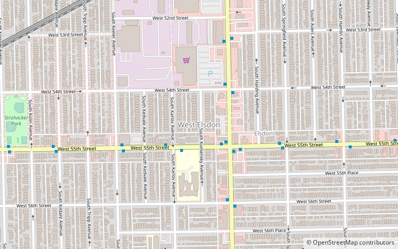
West Elsdon, one of the 77 official community areas, is located on the southwest side of the City of Chicago, Illinois. It is noted as a twin neighborhood of West Lawn. It has a population which includes a mix of dwindling Polish-American residents and increasing Mexican-American residents who currently constitute a clear majority. It has its own association, "West Elsdon Civic Association," which privately organizes the neighborhood. St. Turibius grade school, a Roman Catholic elementary school, located at 57th and Karlov, closed in 2013 and is currently inactive though the building remains and is adjacent to St. Turibius Roman Catholic church. The former Lourdes Roman Catholic girls' high school located from 55th to 56th street from Komensky to Karlov Avenue is now a Chicago Public Schools magnet high school, John Hancock High School. ()
Southwest Side (West Elsdon)Chicago
- Metro
- Bus
 Metro
Metro
- Calculate route55th Street & Pulaski WB 2 min walk
- Calculate routePulaski & 55th Street 3 min walk
- Calculate routePulaski 11 min walk
- Calculate routeMidway 22 min walk
- Calculate routeKedzie 33 min walk
 Rail "L"


Frequently Asked Questions (FAQ)
How to get to West Elsdon by public transport?
Bus
- 55th Street & Pulaski WB • Lines: 55 (2 min walk)
- Pulaski & 55th Street • Lines: 53A (3 min walk)
Metro
- Pulaski • Lines: Orange (11 min walk)
- Midway • Lines: Orange (22 min walk)