Our Lady Help of Christians, Philadelphia
Map
Facts and practical information
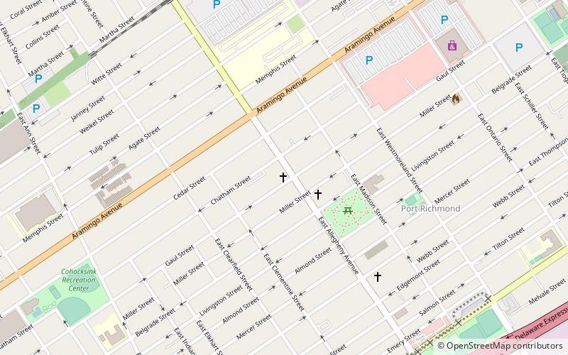
Our Lady Help of Christians is a historic Catholic church at the corner of East Allegheny Avenue and Gaul Street in the Port Richmond section of Philadelphia, Pennsylvania and serves the German-speaking population in the area. ()
Coordinates: 39°59'13"N, 75°6'19"W
Address
River Wards (Richmond)Philadelphia
ContactAdd
Social media
Add
Getting there by public transportation
Public transportation stops near this location
- Metro
 Metro
Metro
- Calculate routeAllegheny 20 min walk
- Calculate routeTioga 24 min walk
Maps SEPTA Regional Rail
SEPTA Regional RailDay trips


Frequently Asked Questions (FAQ)
Which popular attractions are close to Our Lady Help of Christians?
Nearby attractions include St. Adalbert in Philadelphia, Philadelphia (6 min walk), Richmond School, Philadelphia (10 min walk), Memphis Street Academy, Philadelphia (11 min walk), Alternative Middle Years at James Martin School, Philadelphia (12 min walk).
How to get to Our Lady Help of Christians by public transport?
The nearest stations to Our Lady Help of Christians:
Metro
Metro
- Allegheny • Lines: Mfl (20 min walk)
- Tioga • Lines: Mfl (24 min walk)