Eliot, Portland
Map
Facts and practical information
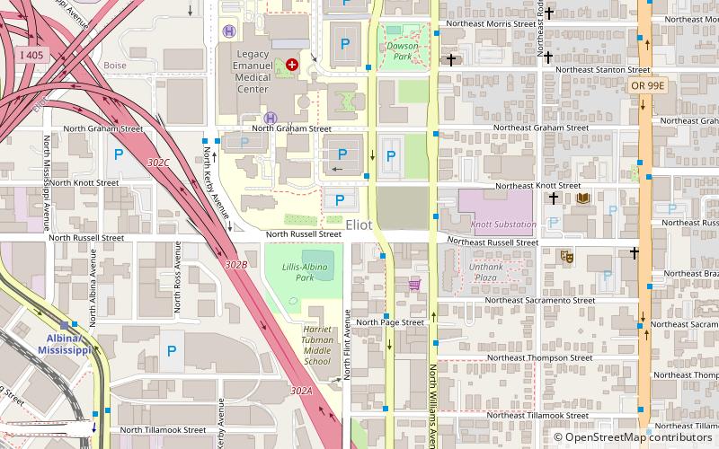
Eliot is a neighborhood in the North and Northeast sections of Portland, Oregon. It is approximately bounded by the Willamette River on the west, NE Fremont Street on the north, NE 7th Avenue on the east, and NE/N Broadway on the south. ()
Coordinates: 45°32'28"N, 122°40'6"W
Getting there by public transportation
Public transportation stops near this location
- Bus
- Tram
- Light rail
- Train
 Bus
Bus
- Calculate routeNorth Vancouver & Russell 2 min walk
- Calculate routeNorth Vancouver & Knott 2 min walk
- Calculate routeNorth Williams & Northeast Russell 3 min walk
- Calculate routeAlbina/Mississippi 10 min walk
- Calculate routeInterstate/Rose Quarter 20 min walk
- Calculate routeRose Quarter Transit Center 20 min walk
- Calculate routeOverlook Park 21 min walk
- Calculate routeNorth Broadway & Ross 12 min walk
- Calculate routeNorth Weidler & Ross 13 min walk
- Calculate routeNortheast Weidler & 2nd 14 min walk
- Calculate routePortland Union Station 25 min walk
Day trips


Frequently Asked Questions (FAQ)
Which popular attractions are close to Eliot?
Nearby attractions include Dawson Park, Portland (6 min walk), Wonder Ballroom, Portland (7 min walk), Portland Institute for Contemporary Art, Portland (8 min walk), Davis Block, Portland (8 min walk).
How to get to Eliot by public transport?
The nearest stations to Eliot:
Bus
Light rail
Tram
Train
Bus
- North Vancouver & Russell • Lines: 4, 44 (2 min walk)
- North Vancouver & Knott • Lines: 24, 4, 44 (2 min walk)
Light rail
- Albina/Mississippi • Lines: Yellow (10 min walk)
- Interstate/Rose Quarter • Lines: Yellow (20 min walk)
Tram
- North Broadway & Ross • Lines: B (12 min walk)
- North Weidler & Ross • Lines: A (13 min walk)
Train
- Portland Union Station (25 min walk)