Mitchell Brothers O'Farrell Theatre, San Francisco

Facts and practical information
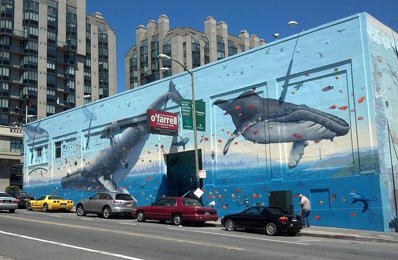
The Mitchell Brothers O'Farrell Theatre was a strip club at 895 O'Farrell Street near San Francisco's Tenderloin neighborhood. Having first opened as an X-rated movie theater by Jim and Artie Mitchell on July 4, 1969, the O'Farrell was one of America's oldest and most notorious adult-entertainment establishments. The club closed in 2020 after a few years of struggling financially. By 1980, the nightspot had popularized close-contact lap dancing, which would become the norm in strip clubs nationwide. Journalist Hunter S. Thompson, a longtime friend of the Mitchells and frequent visitor at the club, went there frequently during the summer of 1985 as part of his research for a possible book on pornography. Thompson called the O'Farrell "the Carnegie Hall of public sex in America" and Playboy magazine praised it as "the place to go in San Francisco!" ()
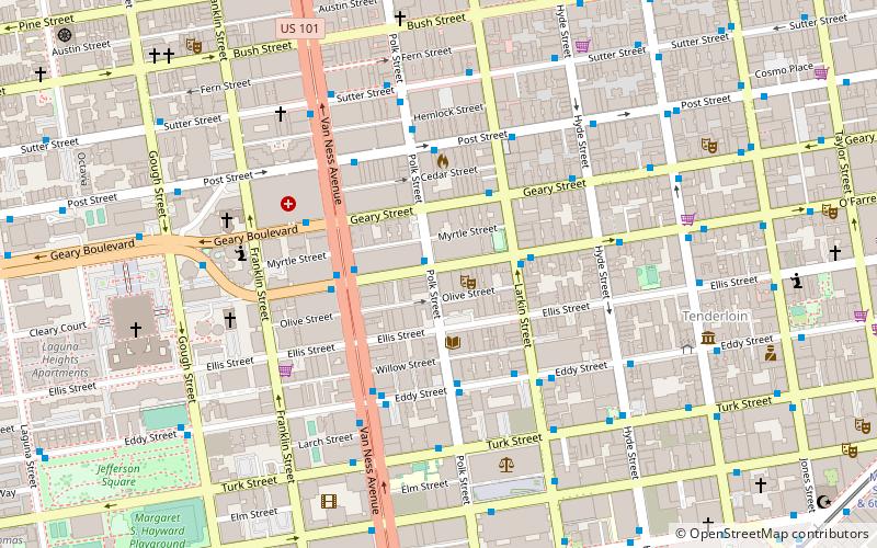
895 O'Farrell StNortheast San Francisco (Tenderloin)San Francisco
- Metro
- Bus
- Trolleybus
- Tram
- Light rail
 Metro
Metro
- Calculate routePolk Street & O'Farrell Street 1 min walk
- Calculate routeLarkin Street & O'Farrell Street 3 min walk
- Calculate routeO'Farrell Street & Larkin Street 3 min walk
- Calculate routeVan Ness Avenue & O'Farrell Street 3 min walk
- Calculate routeCalifornia Street & Polk Street 11 min walk
- Calculate routeCalifornia Street & Van Ness Avenue 11 min walk
- Calculate routeCalifornia Street & Larkin Street 11 min walk
- Calculate routeCalifornia Street & Hyde Street 12 min walk
- Calculate routeSacramento Street & Polk Street 12 min walk
- Calculate routeCivic Center 13 min walk
- Calculate routePowell Street 17 min walk
- Calculate routeVan Ness 18 min walk
- Calculate routeMontgomery Street 26 min walk
- Calculate routeCivic Center 13 min walk
- Calculate routePowell Street 17 min walk
 Muni Metro
Mitchell Brothers O'Farrell Theatre – popular in the area (distance from the attraction)
Nearby attractions include: Great American Music Hall, The Regency Ballroom, San Francisco City Hall, Cathedral of Saint Mary of the Assumption.


Frequently Asked Questions (FAQ)
Which popular attractions are close to Mitchell Brothers O'Farrell Theatre?
How to get to Mitchell Brothers O'Farrell Theatre by public transport?
Bus
- Polk Street & O'Farrell Street • Lines: 19 (1 min walk)
- Larkin Street & O'Farrell Street • Lines: 19 (3 min walk)
Tram
- California Street & Polk Street (11 min walk)
- California Street & Van Ness Avenue (11 min walk)
Trolleybus
- Sacramento Street & Polk Street • Lines: 1 (12 min walk)
Light rail
- Civic Center • Lines: K, N, S, T (13 min walk)
- Powell Street • Lines: K, N, S, T (17 min walk)
Metro
- Civic Center • Lines: Blue, Green, Red, Yellow (13 min walk)
- Powell Street • Lines: Blue, Green, Red, Yellow (17 min walk)