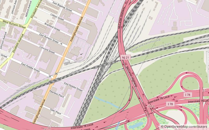
Lehigh Line Connection, Newark
Map
Facts and practical information
The Lehigh Line Connection connects Amtrak's Northeast Corridor with the Conrail Lehigh Line 2 miles south of downtown Newark, New Jersey. It leaves the NEC at Hunter Interlocking, and the line is sometimes called the Hunter Connection. Used by New Jersey Transit Raritan Valley Line trains since 1997 when it replaced an older connection, it splits from the NEC just north of the former connector, with wider radius curves with a maximum speed of 45 mph, compared to the 15 mph of the original alignment. ()
Coordinates: 40°42'46"N, 74°11'8"W
Address
South Broad StreetNewark
ContactAdd
Social media
Add
Getting there by public transportation
Public transportation stops near this location
- Train
 Train
Train
- Calculate routeNewark Liberty Airport 17 min walk
- Calculate routeP4 29 min walk
- Calculate routeTerminal C 32 min walk
Day trips


Frequently Asked Questions (FAQ)
Which popular attractions are close to Lehigh Line Connection?
Nearby attractions include Clinton Hill, Newark (19 min walk), South Broad Valley, Newark (22 min walk), St. Columba's Church, Newark (23 min walk), Newark City Cemetery, Newark (24 min walk).
How to get to Lehigh Line Connection by public transport?
The nearest stations to Lehigh Line Connection:
Train
Train
- Newark Liberty Airport (17 min walk)
- P4 (29 min walk)