Trek Zone

Selden Island

#7230 among destinations in the United States

Island
Selden Island location map
Map

Facts and practical information
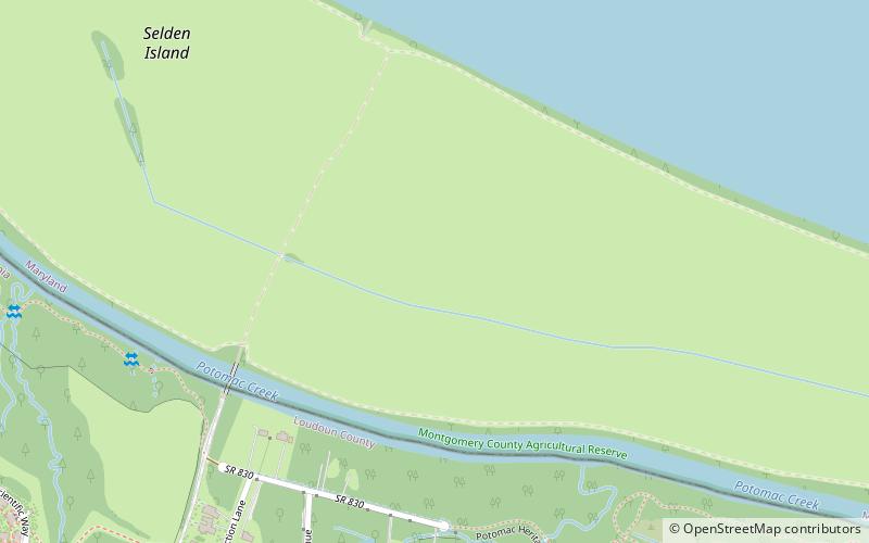
Area: 0.64 mi²Coordinates: 39°4'31"N, 77°27'10"W
Location

MarylandUnited States

ContactAdd
Social media
Add
Day trips

Selden Island – popular in the area (distance from the attraction)

Nearby attractions include: Dulles Town Center, Village at Leesburg, Algonkian Regional Park, Ball's Bluff Battlefield and National Cemetery.

  • dulles town center sterling3.4 miSE
  • village at leesburg location map
    4 miW
  • algonkian regional park sterling4.3 miE
  • balls bluff battlefield and national cemetery leesburg5.5 miNW
  • heritage farm museum sterling4.8 miSE
  • whites ferry leesburg6.6 miNW
  • ashburn presbyterian church3 miSW
  • ashburn park dinosaur park3.2 miSW
  • vestals gap road and lanesville historic district sterling4.8 miSE
  • fort evans leesburg location map
    4.9 miNW
  • warp drive sterling4.4 miS

Where to next? Visit maryland Maryland region page or discover the top tourist attractions in United States.