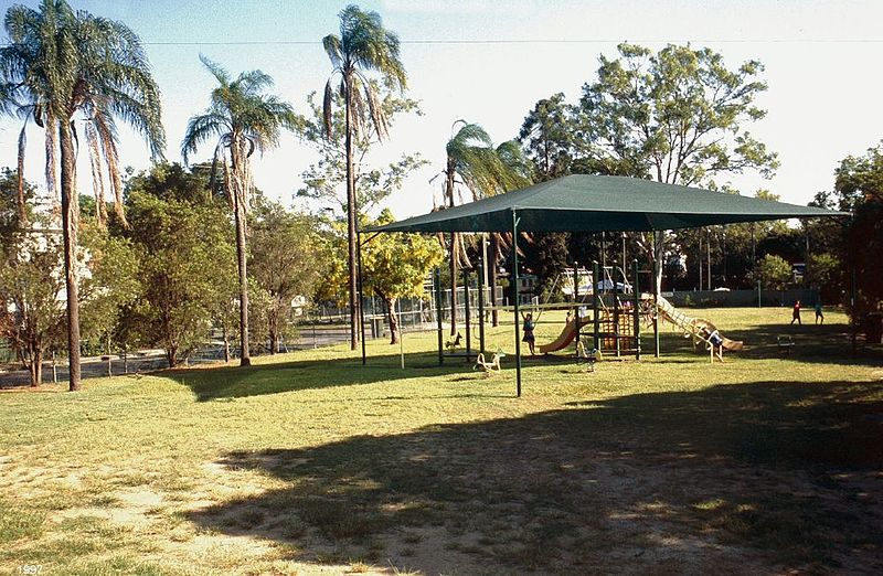
Neal Macrossan Playground, Brisbane

Gallery (3)
Map
Map
Gallery
Facts and practical information
Neal Macrossan Playground is a heritage-listed playground at 14 Caroline Street in the former suburb of Ithaca now Paddington, Brisbane, Queensland, Australia. It was built from 1918 to 1934. It is also known as Ithaca Playground. It was added to the Queensland Heritage Register on 9 May 1998. ()
Elevation: 43 ft a.s.l.Coordinates: 27°27'44"S, 153°0'36"E
Getting there by public transportation
Public transportation stops near this location
- Bus
- Train
- Ferry
 Bus
Bus
- Calculate routeCaxton Street near Chapel Street, stop 4 4 min walk
- Calculate routeHeussler Terrace at Heussler - Suncorp, stop 5 5 min walk
- Calculate routeGiven Terrace at Paddo Tavern stop 6 6 min walk
- Calculate routeMilton 14 min walk
- Calculate routeRoma Street 14 min walk
- Calculate routeCentral 26 min walk
- Calculate routeAuchenflower 32 min walk
- Calculate routeNorth Quay 1 27 min walk
- Calculate routeNorth Quay 2 28 min walk
- Calculate routeSouth Bank Ferry Terminal 1 31 min walk
Day trips


Frequently Asked Questions (FAQ)
Which popular attractions are close to Neal Macrossan Playground?
Nearby attractions include Suncorp Stadium, Brisbane (5 min walk), La Boite Theatre Building, Brisbane (6 min walk), Caxton Street, Brisbane (6 min walk), Brisbane Arts Theatre, Brisbane (7 min walk).
How to get to Neal Macrossan Playground by public transport?
The nearest stations to Neal Macrossan Playground:
Bus
Train
Ferry
Bus
- Caxton Street near Chapel Street, stop 4 • Lines: 476, 61 (4 min walk)
- Heussler Terrace at Heussler - Suncorp, stop 5 • Lines: 476 (5 min walk)
Train
- Milton (14 min walk)
- Roma Street (14 min walk)
Ferry
- North Quay 1 • Lines: Chop-400, Uqsl-1410 (27 min walk)
- North Quay 2 • Lines: Chop-400 (28 min walk)