Camberwell Junction, Melbourne
Map

Map

Facts and practical information
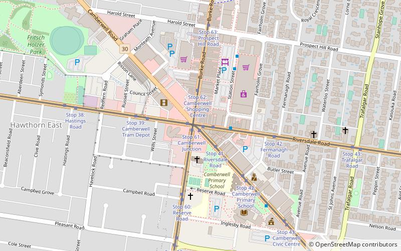
Camberwell Junction is a major intersection in Melbourne, Australia. It is at the intersection of Burke, Riversdale and Camberwell Roads. Trams that pass through the junction are the 70, 72 and 75. The Junction is approximately 500 metres south of Camberwell railway station on the Belgrave, Lilydale and Alamein lines. ()
Coordinates: 37°49'53"S, 145°3'25"E
Day trips
Camberwell Junction – popular in the area (distance from the attraction)
Nearby attractions include: Glenferrie Road, Stockland Tooronga, Burke Road, Our Lady of Victories Basilica.
Frequently Asked Questions (FAQ)
Which popular attractions are close to Camberwell Junction?
Nearby attractions include Our Lady of Victories Basilica, Melbourne (5 min walk), Camberwell Town Hall, Melbourne (7 min walk).
How to get to Camberwell Junction by public transport?
The nearest stations to Camberwell Junction:
Tram
Train
Bus
Tram
- Stop 40: Camberwell Junction • Lines: 70, 70d, 75, 75d (1 min walk)
- Stop 61: Camberwell Junction • Lines: 72, 72a, 72d (1 min walk)
Train
- Camberwell (9 min walk)
- Riversdale (18 min walk)
Bus
- Riversdale Road • Lines: 624 (19 min walk)
- Constance St/Tooronga Rd • Lines: 624 (20 min walk)

 Melbourne Trams
 Victoria Trains


