Gore Hill Freeway, Sydney
Map
Facts and practical information
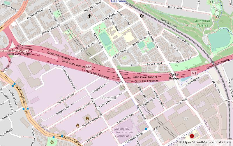
The Gore Hill Freeway is a 4-kilometre divided freeway located in Sydney, New South Wales, Australia. The freeway forms part of the M1, the Sydney Orbital Network, and the Highway 1 network. Construction of the freeway commenced in August 1988 as part of the Bicentennial Roads Program and opened to traffic on 26 August 1992. The primary function of the freeway is to provide an alternative high-grade route from Artarmon to Lane Cove and to reduce traffic demands on the Pacific Highway throughout Sydney's lower north shore, bypassing St Leonards and Gore Hill. ()
Coordinates: 33°48'49"S, 151°11'6"E
Address
Willoughby (Artarmon)Sydney
ContactAdd
Social media
Add
Getting there by public transportation
Public transportation stops near this location
- Metro
- Bus
- Train
 Metro
Metro
- Calculate routeArtarmon 9 min walk
- Calculate routeSt Leonards 21 min walk
- Calculate routeDickson Ave 9 min walk
- Calculate routeHotham Parade 11 min walk
- Calculate routeAlto Pl 12 min walk
- Calculate routeNorth Sydney College TAFE - Westbourne St 15 min walk
- Calculate routeChatswood 29 min walk
Maps Sydney TrainsMaps
 Sydney Light RailMaps
 Sydney Ferries
Sydney TrainsMapsSydney Light RailMapsSydney FerriesDay trips


Frequently Asked Questions (FAQ)
Which popular attractions are close to Gore Hill Freeway?
Nearby attractions include Gore Hill, Sydney (3 min walk), Chatswood Reservoirs No. 1 and No. 2, Sydney (16 min walk), Chatswood South Uniting Church, Sydney (17 min walk), Lane Cove Bushland Park, Sydney (17 min walk).
How to get to Gore Hill Freeway by public transport?
The nearest stations to Gore Hill Freeway:
Train
Bus
Metro
Train
- Artarmon (9 min walk)
- St Leonards (21 min walk)
Bus
- Dickson Ave • Lines: 200, 290 (9 min walk)
- Hotham Parade • Lines: 200, 290 (11 min walk)
Metro
- Chatswood • Lines: Sydney Metro Northwest (29 min walk)