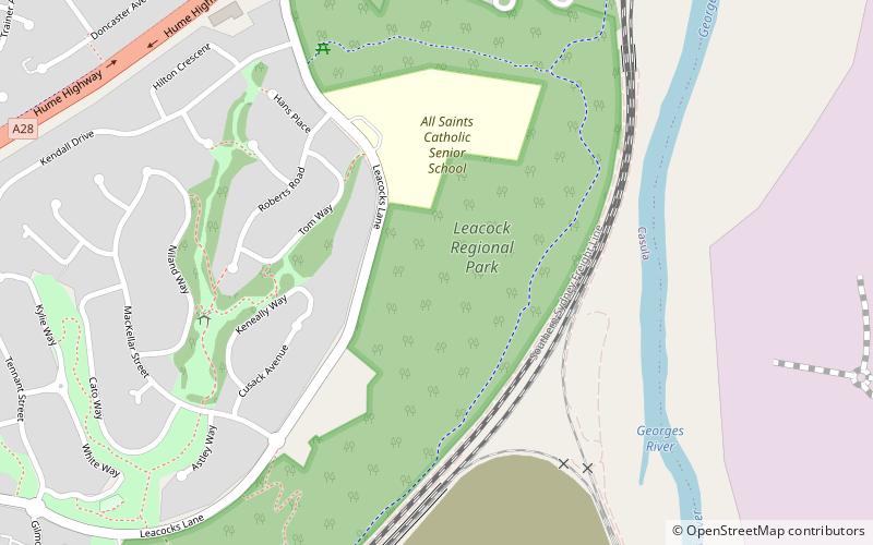
Leacock Regional Park, Sydney
Map
Facts and practical information
Leacock Regional Park, located in Casula, approx. 40 km south-west of Sydney, is a patch of open green space which provides views of Holsworthy bushland from the ridge line. ()
Elevation: 131 ft a.s.l.Coordinates: 33°57'21"S, 150°54'29"E
Address
Liverpool (Casula)Sydney
ContactAdd
Social media
Add
Getting there by public transportation
Public transportation stops near this location
- Train
 Train
Train
- Calculate routeCasula 12 min walk
- Calculate routeGlenfield 37 min walk
Maps Sydney TrainsMaps
 Sydney Light RailMaps
 Sydney Ferries
Sydney TrainsMapsSydney Light RailMapsSydney FerriesDay trips


Frequently Asked Questions (FAQ)
How to get to Leacock Regional Park by public transport?
The nearest stations to Leacock Regional Park:
Train
Train
- Casula (12 min walk)
- Glenfield (37 min walk)