Aberfeldie Park, Melbourne
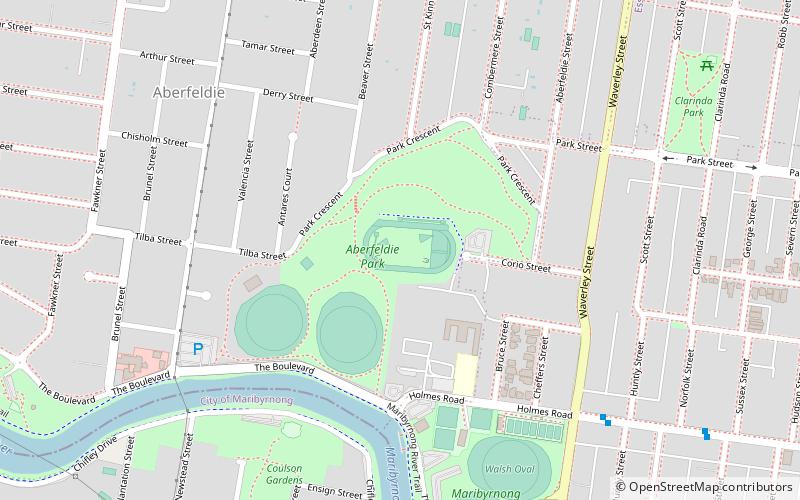
Map
Facts and practical information
Coordinates: 37°45'44"S, 144°54'7"E
Address
Moonee Valley (Aberfeldie)Melbourne
ContactAdd
Social media
Add
Getting there by public transportation
Public transportation stops near this location
- Bus
- Tram
- Train
 Bus
Bus
- Calculate routeStop 42: Clyde Street 14 min walk
- Calculate routeStop 41: Maribyrnong Park 14 min walk
- Calculate routeStop 40: Epsom Road 16 min walk
- Calculate routeStop 43: Van Ness Avenue 16 min walk
- Calculate routeEssendon 23 min walk
- Calculate routeMoonee Ponds 25 min walk
- Calculate routeAscot Vale 36 min walk
- Calculate routeGlenbervie 38 min walk
- Calculate routeEssendon Station 24 min walk
- Calculate routeBuckley Street/Mt Alexander Road 25 min walk
- Calculate routeSt James Street/Mt Alexander Road 26 min walk
- Calculate routeSalvation Army Church/Buckley Street 27 min walk
Maps Melbourne TramsMaps
 Victoria Trains
Melbourne TramsMapsVictoria TrainsDay trips


Frequently Asked Questions (FAQ)
How to get to Aberfeldie Park by public transport?
The nearest stations to Aberfeldie Park:
Tram
Train
Bus
Tram
- Stop 42: Clyde Street • Lines: 57, 57d, 82 (14 min walk)
- Stop 41: Maribyrnong Park • Lines: 57, 57d, 82 (14 min walk)
Train
- Essendon (23 min walk)
- Moonee Ponds (25 min walk)
Bus
- Essendon Station • Lines: 469, 476, 477, 503, 510, 903, Bus 903 (24 min walk)
- Buckley Street/Mt Alexander Road • Lines: 476, 477 (25 min walk)