Burwood rail underbridge, Sydney
Map
Facts and practical information
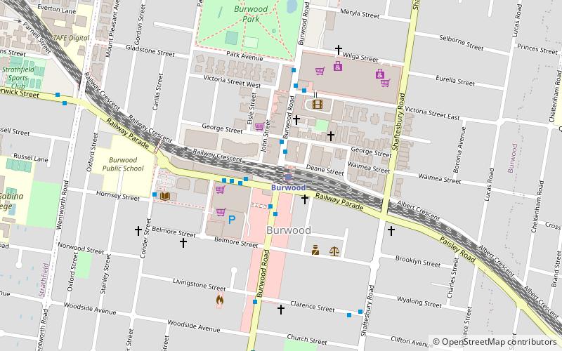
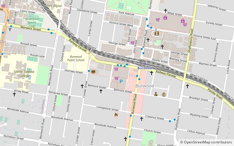
The Burwood rail underbridge is a heritage-listed railway underbridge located on the Main Southern and Main Western railway lines in the Sydney suburb of Burwood, in the Municipality of Burwood local government area of New South Wales, Australia. The triple-girder underbridge spans Burwood Road. The railway bridge was built from 1892 to 1926 by John Ahern. The property is owned by RailCorp, an agency of the Government of New South Wales. It was added to the New South Wales State Heritage Register on 2 April 1999. ()
Coordinates: 33°52'38"S, 151°6'14"E
Address
Inner West (Burwood)Sydney
ContactAdd
Social media
Add
Getting there by public transportation
Public transportation stops near this location
- Bus
- Train
 Bus
Bus
- Calculate routeBurwood 1 min walk
- Calculate routeStrathfield 17 min walk
- Calculate routeCroydon 21 min walk
- Calculate routeHomebush 32 min walk
- Calculate routeBurwood Station 2 min walk
- Calculate routeBurwood Station, Railway Parade, Stand A 2 min walk
- Calculate routeRailway Parade Burwood 2 min walk
Maps Sydney TrainsMaps
 Sydney Light RailMaps
 Sydney Ferries
Sydney TrainsMapsSydney Light RailMapsSydney FerriesDay trips


Frequently Asked Questions (FAQ)
Which popular attractions are close to Burwood rail underbridge?
Nearby attractions include Woodstock, Sydney (9 min walk), Trinity Uniting Church, Strathfield (15 min walk), Brunyarra, Strathfield (16 min walk), Lauriston, Strathfield (16 min walk).
How to get to Burwood rail underbridge by public transport?
The nearest stations to Burwood rail underbridge:
Train
Bus
Train
- Burwood (1 min walk)
- Strathfield (17 min walk)
Bus
- Burwood Station • Lines: 410, 458, 466, M90 (2 min walk)
- Burwood Station, Railway Parade, Stand A • Lines: 458, 466, 525, 526, M90 (2 min walk)