The Loft UTS, Sydney
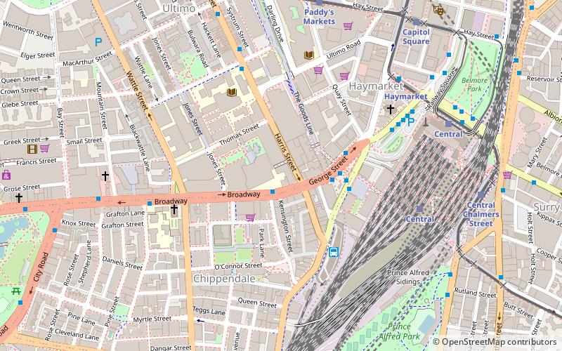
Map
Facts and practical information
The UTS Faculty of Design, Architecture and Building is the faculty of design and architecture at the University of Technology Sydney. It offers bachelor's, master's, and doctoral degrees to more than 4,500 students. ()
Coordinates: 33°53'1"S, 151°12'6"E
Address
15 BroadwaySouth Sydney (Haymarket)Sydney
Contact
+61 2 9514 2345
Social media
Add
Getting there by public transportation
Public transportation stops near this location
- Bus
- Light rail
- Train
- Ferry
 Bus
Bus
- Calculate routeUniversity of Technology Sydney, Broadway 1 min walk
- Calculate routeStand M, Central Station, Railway Square 3 min walk
- Calculate routeStand J, Central Station, Railway Square 4 min walk
- Calculate routeStand N, Central Station, Railway Square 4 min walk
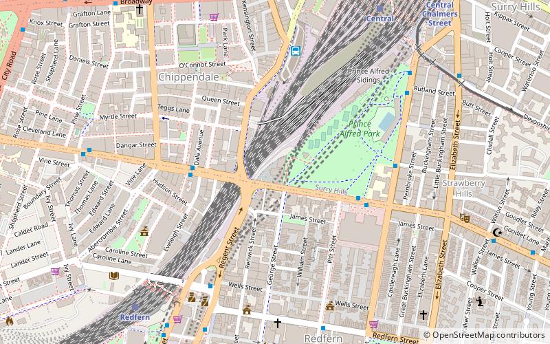
- Calculate routeCentral 6 min walk
- Calculate routeRedfern 16 min walk
- Calculate routeMuseum 19 min walk
- Calculate routeTown Hall 20 min walk
- Calculate routeHaymarket 7 min walk
- Calculate routeCentral 8 min walk
- Calculate routePaddy's Markets 8 min walk
- Calculate routeCentral Chalmers Street 9 min walk
- Calculate routePyrmont Bay Wharf 28 min walk
- Calculate routeBlackwattle Bay Wharf 33 min walk
Maps Sydney TrainsMaps
 Sydney Light RailMaps
 Sydney Ferries
Sydney TrainsMapsSydney Light RailMapsSydney FerriesDay trips


Frequently Asked Questions (FAQ)
Which popular attractions are close to The Loft UTS?
Nearby attractions include Central Park, Sydney (2 min walk), UTS Tower, Sydney (2 min walk), Railway Square road overbridge, Sydney (3 min walk), The Goods Line, Sydney (3 min walk).
How to get to The Loft UTS by public transport?
The nearest stations to The Loft UTS:
Bus
Train
Light rail
Ferry
Bus
- University of Technology Sydney, Broadway • Lines: 431, 433, 438 (1 min walk)
- Stand M, Central Station, Railway Square • Lines: 300, 431, 433 (3 min walk)
Train
- Central (6 min walk)
- Redfern (16 min walk)
Light rail
- Haymarket • Lines: L2, L3 (7 min walk)
- Central • Lines: L1 (8 min walk)
Ferry
- Pyrmont Bay Wharf • Lines: F4, Ferry (28 min walk)
- Blackwattle Bay Wharf (33 min walk)